Wallern im Burgenland | |
|---|---|
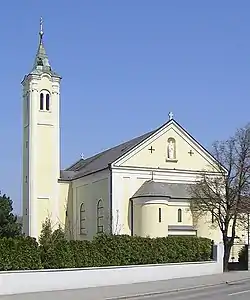 Saint Matthew Church | |
 Coat of arms | |
 Wallern im Burgenland Location within Austria | |
| Coordinates: 47°44′N 16°56′E / 47.733°N 16.933°E | |
| Country | Austria |
| State | Burgenland |
| District | Neusiedl am See |
| Government | |
| • Mayor | Helmut Huber (SPÖ) |
| Area | |
| • Total | 33.91 km2 (13.09 sq mi) |
| Elevation | 120 m (390 ft) |
| Population (2018-01-01)[2] | |
| • Total | 1,702 |
| • Density | 50/km2 (130/sq mi) |
| Time zone | UTC+1 (CET) |
| • Summer (DST) | UTC+2 (CEST) |
| Postal code | 7151 |
Wallern im Burgenland (Hungarian: Valla) is a town in the northeastern part of Burgenland in Austria. It is located in the southern part of the Neusiedl am See district east of the Neusiedlersee, on Route 52 about 5 km (3.1 mi) north of the border at the artificial channel Einserkanal with Hungary.
Population
| Year | Pop. | ±% |
|---|---|---|
| 1869 | 1,243 | — |
| 1880 | 1,359 | +9.3% |
| 1890 | 1,239 | −8.8% |
| 1900 | 1,347 | +8.7% |
| 1910 | 1,613 | +19.7% |
| 1923 | 1,612 | −0.1% |
| 1934 | 1,812 | +12.4% |
| 1939 | 1,878 | +3.6% |
| 1951 | 1,895 | +0.9% |
| 1961 | 2,001 | +5.6% |
| 1971 | 2,061 | +3.0% |
| 1981 | 1,996 | −3.2% |
| 1991 | 1,978 | −0.9% |
| 2001 | 1,980 | +0.1% |
| 2011 | 1,814 | −8.4% |
References
- ↑ "Dauersiedlungsraum der Gemeinden Politischen Bezirke und Bundesländer - Gebietsstand 1.1.2018". Statistics Austria. Retrieved 10 March 2019.
- ↑ "Einwohnerzahl 1.1.2018 nach Gemeinden mit Status, Gebietsstand 1.1.2018". Statistics Austria. Retrieved 9 March 2019.
This article is issued from Wikipedia. The text is licensed under Creative Commons - Attribution - Sharealike. Additional terms may apply for the media files.