| Wehra | |
|---|---|
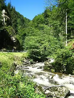 The Wehra in its gorge-like middle reaches | |
| Location | |
| Country | Germany |
| State | Baden-Württemberg |
| Reference no. | DE: 2314 |
| Physical characteristics | |
| Source | |
| • location | In the Berglewald of Todtmoos, east of the village centre |
| • coordinates | 47°45′01″N 8°01′47″E / 47.750398°N 8.029758°E |
| • elevation | about 1,080 m above sea level (NN) |
| Mouth | |
• location | Near Brennet, borough of Wehr into the Rhine |
• coordinates | 47°34′55″N 7°54′13″E / 47.58194°N 7.90361°E |
• elevation | etwa 283 m above sea level (NN) |
| Length | 26.1 km (16.2 mi) [1] |
| Basin size | 114.8 km² [2] |
| Discharge | |
| • location | [2] |
| • average | 3.71 m³/s |
| • minimum | Average low: 680 L/s |
| • maximum | Average high: 32.84 m³/s |
| Basin features | |
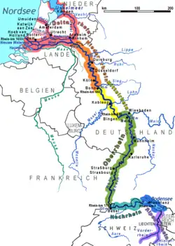
| Progression | Rhine→ North Sea |
| Landmarks |
|
| Tributaries | |
| • right | Rüttebach (main river), Rotmoosbach, Brandbach, Hasel |
| Waterbodies | Reservoirs: Wehra Reservoir |
Wehra is a river of Baden-Württemberg, Germany. It passes through Todtmoos and Wehr and flows into the Rhine downstream of Bad Säckingen.
See also
References
- ↑ Map services of the Baden-Württemberg State Office for the Environment, Survey and Conservation (Landesanstalt für Umwelt, Messungen und Naturschutz Baden-Württemberg)
- 1 2 Büro Hydrosond, Büro E. Kunk: PSW Atdorf, Fachgutachten Hydrogeologie und Thermalquellen Bad Säckingen (pdf; 2.3 MB), 2010, p. 39
This article is issued from Wikipedia. The text is licensed under Creative Commons - Attribution - Sharealike. Additional terms may apply for the media files.