Werningshausen | |
|---|---|
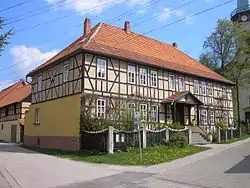 Rectory | |
Location of Werningshausen within Sömmerda district 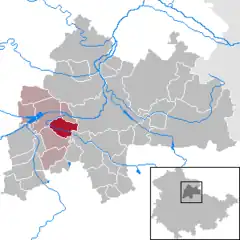 | |
 Werningshausen 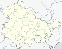 Werningshausen | |
| Coordinates: 51°8′N 11°0′E / 51.133°N 11.000°E | |
| Country | Germany |
| State | Thuringia |
| District | Sömmerda |
| Municipal assoc. | Straußfurt |
| Government | |
| • Mayor (2022–28) | Stefan Rudolph[1] |
| Area | |
| • Total | 12.78 km2 (4.93 sq mi) |
| Elevation | 147 m (482 ft) |
| Population (2022-12-31)[2] | |
| • Total | 655 |
| • Density | 51/km2 (130/sq mi) |
| Time zone | UTC+01:00 (CET) |
| • Summer (DST) | UTC+02:00 (CEST) |
| Postal codes | 99634 |
| Dialling codes | 036376 |
| Vehicle registration | SÖM |
| Website | www.vg-straussfurt.de |
Werningshausen is a municipality in the Sömmerda district of Thuringia, Germany.
References
- ↑ Gewählte Bürgermeister - aktuelle Landesübersicht, Freistaat Thüringen, accessed 10 November 2022.
- ↑ "Bevölkerung der Gemeinden, erfüllenden Gemeinden und Verwaltungsgemeinschaften in Thüringen Gebietsstand: 31.12.2022" (in German). Thüringer Landesamt für Statistik. June 2023.
This article is issued from Wikipedia. The text is licensed under Creative Commons - Attribution - Sharealike. Additional terms may apply for the media files.