| West Fork Stinking River Tributary to Stinking River | |
|---|---|
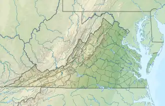 Location of West Fork Stinking River mouth  West Fork Stinking River (the United States) | |
| Location | |
| Country | United States |
| State | Virginia |
| County | Pittsylvania |
| Physical characteristics | |
| Source | Sycamore Creek divide |
| • location | about 3.5 miles southeast of Sycamore, Virginia |
| • coordinates | 36°59′47″N 079°19′45″W / 36.99639°N 79.32917°W[1] |
| • elevation | 875 ft (267 m)[2] |
| Mouth | |
• location | about 1 mile northwest of Greenfield, Virginia |
• coordinates | 36°57′30″N 079°17′56″W / 36.95833°N 79.29889°W[1] |
• elevation | 625 ft (191 m)[3] |
| Length | 4.75 mi (7.64 km)[4] |
| Basin size | 3.67 square miles (9.5 km2)[5] |
| Discharge | |
| • location | Stinking River |
| • average | 4.97 cu ft/s (0.141 m3/s) at mouth with Stinking River[5] |
| Basin features | |
| Progression | Stinking River → Banister River → Dan River → Roanoke River → Albemarle Sound → Pamlico Sound → Atlantic Ocean |
| River system | Roanoke River |
| Tributaries | |
| • left | unnamed tributaries |
| • right | unnamed tributaries |
| Bridges | Deer View Road, Tucker Road |
West Fork Stinking River is a 4.75 mi (7.64 km) long 2nd order tributary to the Stinking River in Pittsylvania County, Virginia. This is the only stream of this name in the United States.[1]
Course
West Fork Stinking River rises about 3.5 miles southeast of Sycamore, Virginia and then flows generally southeast to join the Stinking River about 1 mile northwest of Greenfield.[3]
Watershed
West Fork Stinking River drains 3.67 square miles (9.5 km2) of area, receives about 45.6 in/year of precipitation, has a wetness index of 413.18, and is about 43% forested.[5]
See also
References
- 1 2 3 "GNIS Detail - West Fork Stinking River". geonames.usgs.gov. US Geological Survey. Retrieved 7 August 2021.
- ↑ "Get Maps". USGS Topoview. US Geological Survey. Retrieved 7 August 2021.
- 1 2 "Get Maps". USGS Topoview. US Geological Survey. Retrieved 7 August 2021.
- ↑ "ArcGIS Web Application". epa.maps.arcgis.com. US EPA. Retrieved 7 August 2021.
- 1 2 3 "West Fork Stinking River Watershed Report". US EPA Geoviewer. US EPA. Retrieved 7 August 2021.
This article is issued from Wikipedia. The text is licensed under Creative Commons - Attribution - Sharealike. Additional terms may apply for the media files.