West Tanjung Jabung
(Kabupaten Tanjung Jabung Barat) | |
|---|---|
|
Coat of arms | |
| Motto: Serengkuh Dayung Serentak Ketujuan | |
 | |
| Country | Indonesia |
| Province | Jambi |
| Regency seat | Kuala Tungkal |
| Area | |
| • Total | 5,009.82 km2 (1,934.30 sq mi) |
| Population (mid 2022 estimate)[1] | |
| • Total | 326,530 |
| • Density | 65/km2 (170/sq mi) |
| Time zone | UTC+7 (WIB) |
| Website | tanjabbarkab.go.id |
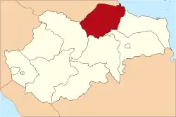
West Tanjung Jabung Regency is a regency of Jambi Province, Indonesia. It is located on the island of Sumatra. The regency was created on 4 October 1999 by the division of the then Tanjung Jabung Regency into eastern and western halves. It now has an area of 5,009.82 km2 and had a population of 278,741 as at the 2010 census[2] and 317,498 at the 2020 census;[3] the official estimate as at mid 2022 was 326,530 (comprising 168,379 males and 158,151 females).[1] The regency seat is Kuala Tungkal.
Administrative districts
The regency is divided into thirteen districts (kecamatan), tabulated below with their areas and their populations at the 2010 census[2] and the 2020 census,[3] together with the official estimates as at mid 2022.[1] The table also includes the locations of the district administrative centres, and the number of villages in each district (totaling 114 rural desa and 20 urban kelurahan - the latter comprising 8 in Tungkal Ilir District, and one in each of the other 12 districts), and its post code.
| Kode Wilayah | Name of District (kecamatan) | Area in km2 | Pop'n 2010 census | Pop'n 2020 census | Pop'n mid 2022 estimate | Admin centre | No. of villages | Post code |
|---|---|---|---|---|---|---|---|---|
| 15.06.01 | Tungkal Ulu | 345.69 | 12,586 | 14,520 | 14,575 | Pelabuhan Dagang | 10 | 36552 |
| 15.06.05 | Merlung | 311.65 | 15,302 | 16,196 | 16,260 | Merlung | 10 | 36554 |
| 15.06.07 | Batang Asam | 1,042.37 | 23,728 | 32,423 | 33,990 | Dusun Kebun | 11 | 36550 |
| 15.06.06 | Tebing Tinggi | 342.89 | 34,164 | 36,228 | 36,420 | Tebing Tinggi | 10 | 36551 |
| 15.06.08 | Renau Mendaluh | 473.72 | 11,828 | 15,166 | 15,494 | Lubuk Kambing | 10 | 36559 |
| 15.06.09 | Muara Papalik | 336.38 | 10,307 | 10,831 | 10,462 | Rantau Badak | 10 | 36558 |
| 15.06.03 | Pengabuan | 440.13 | 23,404 | 25,514 | 26,529 | Teluk Nilau | 13 | 36553 |
| 15.06.13 | Senyerang | 426.63 | 22,393 | 24,249 | 25,163 | Senyerang | 10 | 36513 |
| 15.06.02 | Tungkal Ilir | 100.31 | 67,817 | 72,795 | 75,204 | Kuala Tungkal | 10 (a) | 36557 |
| 15.06.11 | Bram Itam | 312.66 | 14,730 | 18,345 | 19,220 | Bram Itam Kiri | 10 | 36514 |
| 15.06.10 | Seberang Kota | 121.29 | 8,203 | 8,824 | 9,144 | Tungkal V | 8 | 36511 |
| 15.06.04 | Betara | 570.21 | 23,904 | 29,180 | 30,218 | Mekar Jaya | 12 | 36555 |
| 15.06.12 | Kuala Betara | 185.89 | 10.375 | 13,227 | 13,851 | Betara Kiri | 10 | 36556 |
| Totals | 5,009.82 | 278,741 | 317,498 | 326,530 | Kuala Tungkal | 134 |
Note: (a) comprises 8 kelurahan and 2 desa.
References
External links
- Official site (in Indonesian)
1°03′00″S 102°55′59″E / 1.05000°S 102.93306°E