West Waynesburg, Pennsylvania | |
|---|---|
 West Waynesburg  West Waynesburg | |
| Coordinates: 39°54′00″N 80°12′03″W / 39.90000°N 80.20083°W | |
| Country | United States |
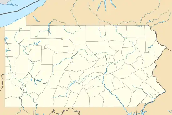
| State | Pennsylvania |
| County | Greene |
| Area | |
| • Total | 0.22 sq mi (0.56 km2) |
| • Land | 0.22 sq mi (0.56 km2) |
| • Water | 0.0 sq mi (0.0 km2) |
| Elevation | 978 ft (298 m) |
| Population (2010) | |
| • Total | 446 |
| • Density | 2,067/sq mi (797.9/km2) |
| Time zone | UTC-5 (Eastern (EST)) |
| • Summer (DST) | UTC-4 (EDT) |
| FIPS code | 42-84176 |
| GNIS feature ID | 2630048 |
West Waynesburg is a census-designated place in Franklin Township, Greene County, Pennsylvania, United States. It is located next to the western border of Waynesburg, the Greene County seat, within a mile of downtown, along Pennsylvania Routes 18 and 21. As of the 2010 census, the population of West Waynesburg was 446.[1]
References
- ↑ "Geographic Identifiers: 2010 Demographic Profile Data (G001): West Waynesburg CDP, Pennsylvania". American Factfinder. U.S. Census Bureau. Retrieved February 8, 2017.
External links
Municipalities and communities of Greene County, Pennsylvania, United States | ||
|---|---|---|
| Boroughs | 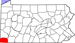 | |
| Townships | ||
| CDPs | ||
| Unincorporated communities | ||
This article is issued from Wikipedia. The text is licensed under Creative Commons - Attribution - Sharealike. Additional terms may apply for the media files.