| Winnemucca Mountain | |
|---|---|
_in_Winnemucca%252C_Nevada-cropped.jpg.webp) View towards Winnemucca Mountain from Nevada State Route 794 in Winnemucca | |
| Highest point | |
| Elevation | 6742+ ft (2055+ m)[1] |
| Prominence | 1,919 ft (585 m)[1] |
| Coordinates | 41°00′39″N 117°46′03″W / 41.010911008°N 117.767582942°W[2] |
| Geography | |
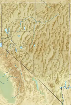 Winnemucca Mountain Nevada, U.S. | |
| Location | Humboldt County, Nevada, U.S. |
| Parent range | Santa Rosa Range |
Winnemucca Mountain is a mountain near the small city of Winnemucca in Humboldt County, Nevada, United States. It is considered to be the southernmost named summit of the Santa Rosa Range.[3] A paved road ascends to radio facilities on the summit.
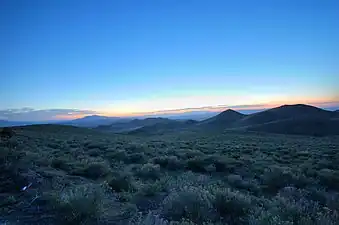 Sunset from the Winnemucca Mountain Road
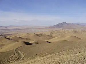 View north-northwest from the summit
References
- 1 2 "Winnemucca Mountain". Peakbagger.com. Retrieved 2014-01-28.
- ↑ "Winnemucca". NGS Data Sheet. National Geodetic Survey, National Oceanic and Atmospheric Administration, United States Department of Commerce. Retrieved 2014-01-30.
- ↑ "Santa Rosa Santa Rosa Mountains". Peakbagger.com. Retrieved 2014-01-28.
External links
 Media related to Winnemucca Mountain at Wikimedia Commons
This article is issued from Wikipedia. The text is licensed under Creative Commons - Attribution - Sharealike. Additional terms may apply for the media files.