Wintersburg, Arizona | |
|---|---|
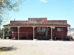 Wintersburg Post Office – 1931 | |
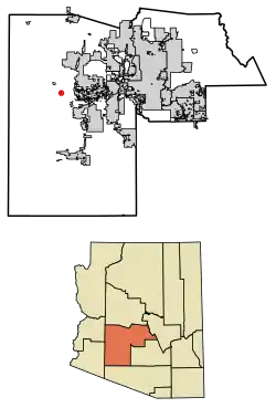 Location in Maricopa County, Arizona | |
 Wintersburg  Wintersburg | |
| Coordinates: 33°25′28″N 112°52′05″W / 33.42444°N 112.86806°W | |
| Country | United States |
| State | Arizona |
| County | Maricopa |
| Area | |
| • Total | 0.59 sq mi (1.53 km2) |
| • Land | 0.59 sq mi (1.53 km2) |
| • Water | 0.00 sq mi (0.00 km2) |
| Elevation | 1,008 ft (307 m) |
| Population | |
| • Total | 51 |
| • Density | 86.15/sq mi (33.24/km2) |
| Time zone | UTC-7 (Mountain (MST)) |
| ZIP code | 85354 (Tonopah) |
| FIPS code | 04-84000 |
Wintersburg is an unincorporated community and census-designated place in Maricopa County, Arizona, United States, located 48 miles (77 km) west of downtown Phoenix and 17 miles (27 km) west of Buckeye along Salome Highway. It is 4 miles (6 km) south of Exit 98 on Interstate 10. As of the 2020 census, Wintersburg had a population of 51,[2] down from 136 in 2010.
Wintersburg is home to the Palo Verde Nuclear Generating Station, the largest nuclear power plant in the United States.
Demographics
| Census | Pop. | Note | %± |
|---|---|---|---|
| 2010 | 136 | — | |
| 2020 | 51 | −62.5% | |
| U.S. Decennial Census[3] | |||
As of the census[4] of 2010, there were 136 people living in the CDP. The population density was 274.5 people per square mile. The racial makeup of the CDP was 82% White, 2% Black or African American, 1% Native American, 2% Pacific Islander, and 12% from other races. 26% of the population were Hispanic or Latino of any race.
Images of Wintersburg
These are some images of Wintersburg
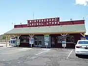 General store
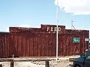 Feed store
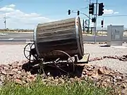 19th century water barrel cart
References
- ↑ "2021 U.S. Gazetteer Files: Arizona". United States Census Bureau. Retrieved May 18, 2022.
- 1 2 "Wintersburg CDP, Arizona: 2020 DEC Redistricting Data (PL 94-171)". U.S. Census Bureau. Retrieved May 18, 2022.
- ↑ "Census of Population and Housing". Census.gov. Retrieved June 4, 2016.
- ↑ United States Census
Municipalities and communities of Maricopa County, Arizona, United States | ||
|---|---|---|
| Cities | 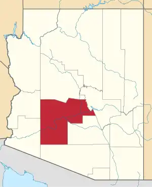 | |
| Towns | ||
| CDPs | ||
| Populated places |
| |
| Indian reservations | ||
| Ghost towns/ former populated places | ||
| Footnotes | ‡This populated place also has portions in an adjacent county or counties | |