Worcester, Pennsylvania | |
|---|---|
Unincorporated community | |
 Worcester | |
| Coordinates: 40°12′04″N 75°20′48″W / 40.20111°N 75.34667°W | |
| Country | United States |
| State | Pennsylvania |
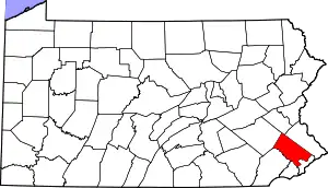
| County | Montgomery |
| Township | Worcester |
| Elevation | 236 ft (72 m) |
| Time zone | UTC-5 (Eastern (EST)) |
| • Summer (DST) | UTC-4 (EDT) |
| ZIP code | 19490 |
| Area code(s) | 610 and 484 |
| GNIS feature ID | 1204994[1] |
Worcester is an unincorporated community in Worcester Township in Montgomery County, Pennsylvania, United States. Worcester is located at the intersection of Pennsylvania Route 73 and Pennsylvania Route 363.[2]
References
- ↑ "Worcester". Geographic Names Information System. United States Geological Survey, United States Department of the Interior.
- ↑ Montgomery County, Pennsylvania Highway Map (PDF) (Map). PennDOT. 2015. Retrieved January 12, 2016.
This article is issued from Wikipedia. The text is licensed under Creative Commons - Attribution - Sharealike. Additional terms may apply for the media files.