Wrestedt | |
|---|---|
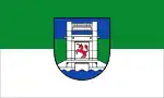 Flag  Coat of arms | |
Location of Wrestedt within Uelzen district 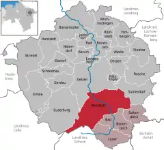 | |
 Wrestedt 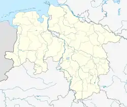 Wrestedt | |
| Coordinates: 52°54′N 10°35′E / 52.900°N 10.583°E | |
| Country | Germany |
| State | Lower Saxony |
| District | Uelzen |
| Municipal assoc. | Aue |
| Subdivisions | 6 |
| Government | |
| • Mayor | Heinz-Hermann Schulze (CDU) |
| Area | |
| • Total | 140.8 km2 (54.4 sq mi) |
| Elevation | 51 m (167 ft) |
| Population (2021-12-31)[1] | |
| • Total | 6,377 |
| • Density | 45/km2 (120/sq mi) |
| Time zone | UTC+01:00 (CET) |
| • Summer (DST) | UTC+02:00 (CEST) |
| Postal codes | 29559 |
| Dialling codes | 05802 |
| Vehicle registration | UE |
| Website | www.wrestedt.de |
Wrestedt is a municipality in the district of Uelzen, in Lower Saxony, Germany. It is situated approximately 7 km south of Uelzen. Wrestedt is the seat of the Samtgemeinde ("collective municipality") Aue, which consists of the municipalities Bad Bodenteich, Lüder, Soltendieck, and Wrestedt.
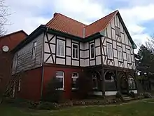
Alcove house in Drohe
References
External links
Towns and municipalities in Uelzen (district) | ||
|---|---|---|
This article is issued from Wikipedia. The text is licensed under Creative Commons - Attribution - Sharealike. Additional terms may apply for the media files.