| Yèvre | |
|---|---|
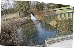 The Yèvre at Dampierre-le-Château | |
.png.webp) | |
| Location | |
| Country | France |
| Physical characteristics | |
| Source | |
| • location | Somme-Yèvre |
| Mouth | Auve |
• coordinates | 49°03′50″N 4°48′28″E / 49.06391°N 4.80783°E |
| Length | 17.23 kilometres (10.71 mi) |
| Basin features | |
| Progression | Auve→ Aisne→ Oise→ Seine→ English Channel |
| Tributaries | |
| • left | Huye, Rouillat |
The Yèvre (French pronunciation: [jɛvʁ]) is a river of the Marne department in the Grand Est region of France. It is 17.23 kilometres (10.71 mi) long.[1] It has its source at Somme-Yèvre and flows through Dommartin-Varimont, Dampierre-le-Château, Rapsécourt, Voilemont and Dommartin-Dampierre.[1]
References
- 1 2 Sandre. "Fiche cours d'eau - L'Yevre (H1045000)". Retrieved 2020-08-24.
This article is issued from Wikipedia. The text is licensed under Creative Commons - Attribution - Sharealike. Additional terms may apply for the media files.