Zacatelco Municipality | |
|---|---|
 Historic center of Zacatelco | |
| Country | |
| State | Tlaxcala |
| Time zone | UTC-6 (Central Standard Time) |
| • Summer (DST) | UTC-5 (Central Daylight Time) |
Zacatelco Municipality is a municipality in the Mexican state of Tlaxcala in south-eastern Mexico.[1]
Geography
Climate
| Climate data for Zacatelco | |||||||||||||
|---|---|---|---|---|---|---|---|---|---|---|---|---|---|
| Month | Jan | Feb | Mar | Apr | May | Jun | Jul | Aug | Sep | Oct | Nov | Dec | Year |
| Mean daily maximum °C (°F) | 23.1 (73.6) |
25.1 (77.2) |
26.7 (80.1) |
28.5 (83.3) |
29.0 (84.2) |
26.4 (79.5) |
25.8 (78.4) |
25.5 (77.9) |
25.4 (77.7) |
25.1 (77.2) |
25.1 (77.2) |
23.0 (73.4) |
25.7 (78.3) |
| Mean daily minimum °C (°F) | 3.3 (37.9) |
4.7 (40.5) |
6.4 (43.5) |
8.3 (46.9) |
9.5 (49.1) |
11.0 (51.8) |
9.8 (49.6) |
10 (50) |
10.3 (50.5) |
9 (48) |
6.6 (43.9) |
4.4 (39.9) |
8 (46) |
| Average precipitation mm (inches) | 7.6 (0.3) |
2.5 (0.1) |
10 (0.4) |
33 (1.3) |
66 (2.6) |
170 (6.5) |
150 (5.8) |
170 (6.8) |
150 (5.9) |
69 (2.7) |
15 (0.6) |
10 (0.4) |
850 (33.3) |
| Source: Weatherbase [2] | |||||||||||||
References
- ↑ "-". Enciclopedia de los Municipios de México. Instituto Nacional para el Federalismo y el Desarrollo Municipal. Retrieved January 4, 2010.
- ↑ "Weatherbase: Historical Weather for Zacatelco, Tlaxcala". Weatherbase. 2011. Retrieved on November 24, 2011.
Tlaxcala de Xicohténcatl (capital) | ||
| Cities | 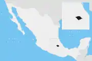 | |
| Municipalities | ||
| History | ||
| Sights | ||
19°13′N 98°14′W / 19.217°N 98.233°W
This article is issued from Wikipedia. The text is licensed under Creative Commons - Attribution - Sharealike. Additional terms may apply for the media files.