Zbojné | |
|---|---|
Municipality | |
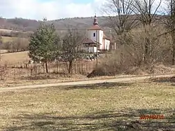 Church in Zbojné | |
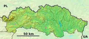 Zbojné Location of Zbojné in the Prešov Region 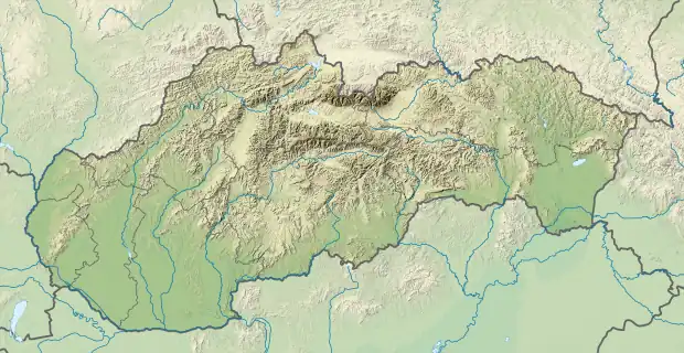 Zbojné Location of Zbojné in Slovakia | |
| Coordinates: 49°08′0″N 22°00′0″E / 49.13333°N 22.00000°E | |
| Country | |
| Region | Prešov |
| District | Medzilaborce |
| First mentioned | 1463 |
| Area | |
| • Total | 18.15[1] km2 (7.01[1] sq mi) |
| Elevation | 262[2] m (860[2] ft) |
| Population (2021) | |
| • Total | 155[3] |
| Time zone | UTC+1 (CET) |
| • Summer (DST) | UTC+2 (CEST) |
| Postal code | 067 14[2] |
| Area code | +421 57[2] |
| Car plate | ML |
| Website | www |
Zbojné (Hungarian: Bajna) is a village and municipality in the Medzilaborce District in the Prešov Region of far north-eastern Slovakia.
History
In historical records the village was first mentioned in 1463.
Geography
The municipality lies at an altitude of 265 metres and covers an area of 18.155 km². It has a population of about 200 people.
Gallery
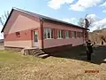 Former primary school building in Zbojné, now converted into the municipality's funeral home
References
- 1 2 "Hustota obyvateľstva - obce [om7014rr_ukaz: Rozloha (Štvorcový meter)]". www.statistics.sk (in Slovak). Statistical Office of the Slovak Republic. 2022-03-31. Retrieved 2022-03-31.
- 1 2 3 4 "Základná charakteristika". www.statistics.sk (in Slovak). Statistical Office of the Slovak Republic. 2015-04-17. Retrieved 2022-03-31.
- ↑ "Počet obyvateľov podľa pohlavia - obce (ročne)". www.statistics.sk (in Slovak). Statistical Office of the Slovak Republic. 2022-03-31. Retrieved 2022-03-31.
External links
 Media related to Zbojné at Wikimedia Commons
- Official website

- https://web.archive.org/web/20071116010355/http://www.statistics.sk/mosmis/eng/run.html
Municipalities of Medzilaborce District | ||
|---|---|---|
This article is issued from Wikipedia. The text is licensed under Creative Commons - Attribution - Sharealike. Additional terms may apply for the media files.