Zyba, Kansas | |
|---|---|
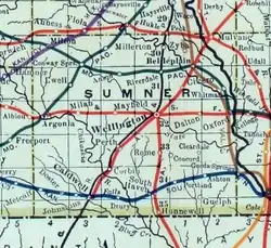 1915 Railroad Map of Sumner County | |
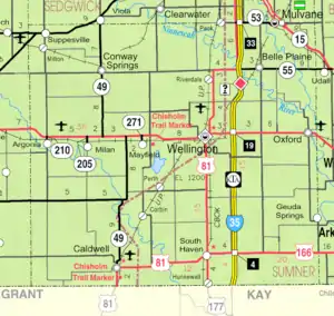 KDOT map of Sumner County (legend) | |
 Zyba  Zyba | |
| Coordinates: 37°26′05″N 97°23′21″W / 37.43472°N 97.38917°W[1] | |
| Country | United States |
| State | Kansas |
| County | Sumner |
| Elevation | 1,230 ft (370 m) |
| Time zone | UTC-6 (CST) |
| • Summer (DST) | UTC-5 (CDT) |
| Area code | 620 |
| FIPS code | 20-81050 |
| GNIS ID | 484508 [1] |
Zyba is an unincorporated community in Sumner County, Kansas, United States.[1] It is located about 4 miles southwest of the Kansas Star Casino at N West St and E 120th Ave N, next to the railroad and Ninnescah River.
History
A post office was opened in Zyba in 1887, and remained in operation until it was discontinued in 1906.[2]
Education
The community is served by Belle Plaine USD 357 public school district.
References
- 1 2 3 4 "Zyba, Kansas", Geographic Names Information System, United States Geological Survey, United States Department of the Interior
- ↑ "Kansas Post Offices, 1828-1961, page 2". Kansas Historical Society. Retrieved June 27, 2014.
Further reading
External links
- Sumner County map, KDOT
Municipalities and communities of Sumner County, Kansas, United States | ||
|---|---|---|
| Cities | 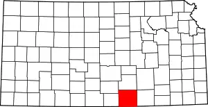 Map of Kansas highlighting Sumner County | |
| Unincorporated communities | ||
| Ghost towns | ||
| Footnotes | †This community is designated a Census-Designated Place (CDP) by the United States Census Bureau. ‡This community also has portions in an adjacent county or counties. | |
This article is issued from Wikipedia. The text is licensed under Creative Commons - Attribution - Sharealike. Additional terms may apply for the media files.