Anhée
| |
|---|---|
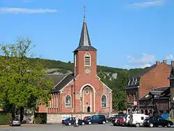 St. Martin's Church | |
 Flag  Coat of arms | |
Location of Anhée | |
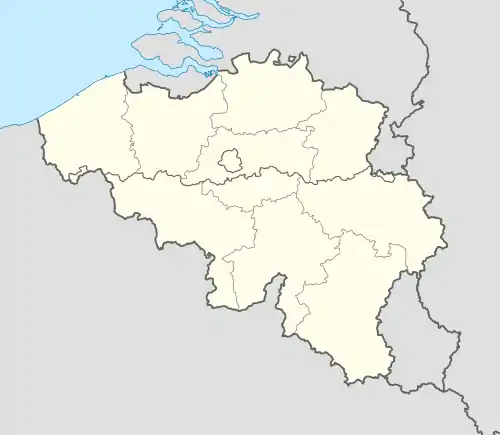 Anhée Location in Belgium
Location of Anhée in Namur province 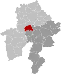 | |
| Coordinates: 50°19′N 04°53′E / 50.317°N 4.883°E | |
| Country | |
| Community | French Community |
| Region | Wallonia |
| Province | Namur |
| Arrondissement | Dinant |
| Government | |
| • Mayor | Luc Piette |
| • Governing party/ies | VIC |
| Area | |
| • Total | 66.03 km2 (25.49 sq mi) |
| Population (2018-01-01)[1] | |
| • Total | 7,117 |
| • Density | 110/km2 (280/sq mi) |
| Postal codes | 5537 |
| NIS code | 91005 |
| Area codes | 082 |
| Website | www.anhee.be |
Anhée (French pronunciation: [ɑ̃.e] ; Walloon: Anhêye) is a municipality of Wallonia located in the province of Namur, Belgium.
On 1 January 2006 the municipality had 6,934 inhabitants. The total area is 65.67 km2, giving a population density of 106 inhabitants per km2.
The municipality consists of the following districts: Anhée, Annevoie-Rouillon, Bioul, Denée, Haut-le-Wastia, Sosoye and Warnant.
The village of Bioul contains Vaxelaire Castle (Château Vaxelaire). Maredsous Abbey and Maredret Abbey are located near Denée.[2]
.JPG.webp)
Vaxelaire Castle in Bioul
See also
References
- ↑ "Wettelijke Bevolking per gemeente op 1 januari 2018". Statbel. Retrieved 9 March 2019.
- ↑ Maredsous Abbey, Contacts, accessed 23 July 2021
External links
 Media related to Anhée at Wikimedia Commons
- Official website
Places adjacent to Anhée | ||||||||||||||||
|---|---|---|---|---|---|---|---|---|---|---|---|---|---|---|---|---|
| ||||||||||||||||
Municipalities in the province of Namur, Wallonia | ||
|---|---|---|
| Dinant |  | |
| Namur | ||
| Philippeville | ||
Bold indicates cities | ||
This article is issued from Wikipedia. The text is licensed under Creative Commons - Attribution - Sharealike. Additional terms may apply for the media files.