Arachovitika
Αραχωβίτικα | |
|---|---|
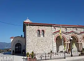 The main church of Arachovitika dedicated to Saint Andrew | |
 Arachovitika | |
| Coordinates: 38°19′N 21°50′E / 38.317°N 21.833°E | |
| Country | Greece |
| Administrative region | West Greece |
| Regional unit | Achaea |
| Municipality | Patras |
| Municipal unit | Rio |
| Districts | 2 |
| Highest elevation | 10 m (30 ft) |
| Lowest elevation | 0 m (0 ft) |
| Population (2011)[1] | |
| • Rural | 305 |
| Community | |
| • Population | 902 (2011) |
| Time zone | UTC+2 (EET) |
| • Summer (DST) | UTC+3 (EEST) |
| Postal code | 265 00 |
| Area code(s) | 2610 |
| Vehicle registration | AX |
Arachovitika (Greek: Αραχωβίτικα) is a village and a community in the municipal unit of Rio in the northern part of Achaea, Greece. It is situated on the Gulf of Corinth, 1 km northwest of Drepano and 6 km northeast of Rio. The Greek National Road 8A (Patras - Corinth) passes south of the village, and the railway Patras - Corinth runs through the village. The community consists of the villages Arachovitika and Kato Arachovitika. There is a port next to Cape Drepano.
Historical population
| Year | Population village | Population community |
|---|---|---|
| 1981 | - | 519 |
| 1991 | 400 | 734 |
| 2001 | 492 | 743 |
| 2011 | 305 | 902 |
See also
References
- 1 2 "Απογραφή Πληθυσμού - Κατοικιών 2011. ΜΟΝΙΜΟΣ Πληθυσμός" (in Greek). Hellenic Statistical Authority.
This article is issued from Wikipedia. The text is licensed under Creative Commons - Attribution - Sharealike. Additional terms may apply for the media files.