Mintilogli
Μιντιλόγλι | |
|---|---|
 Mintilogli | |
| Coordinates: 38°11′N 21°42′E / 38.183°N 21.700°E | |
| Country | Greece |
| Geographic region | Peloponnese |
| Administrative region | West Greece |
| Regional unit | Achaea |
| Municipality | Patras |
| Municipal unit | Paralia |
| Population (2011)[1] | |
| • Rural | 2,120 |
| Community | |
| • Population | 2,363 (2011) |
| Time zone | UTC+2 (EET) |
| • Summer (DST) | UTC+3 (EEST) |
| Postal code | 265 00 |
| Area code(s) | 2610 xxx xxx |
| Vehicle registration | AX |
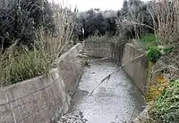
Ligias, a torrent in Mintilogli
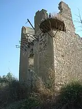
Bey Mintiloglou old house ruins
Mintilogli or Midilogli (Greek: Μιντιλόγλι /midi'loɣli/) is a village and a community in the municipal unit of Paralia in the municipality of Patras in Achaea, Greece. It is 1 km south of Paralia, and 8 km southwest of Patras city centre. Ovrya is to the east. The community consists of the villages Mintilogli (seat) and Chantziliako. Its population is around 2,000. Greek National Road 9 (Patras - Pyrgos) passes the village on the north and west.
See also
References
- 1 2 "Απογραφή Πληθυσμού - Κατοικιών 2011. ΜΟΝΙΜΟΣ Πληθυσμός" (in Greek). Hellenic Statistical Authority.
This article is issued from Wikipedia. The text is licensed under Creative Commons - Attribution - Sharealike. Additional terms may apply for the media files.