Beniflà | |
|---|---|
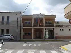 Beniflà town hall | |
 Beniflà Location in Spain | |
| Coordinates: 38°55′44″N 0°11′21″W / 38.92889°N 0.18917°W | |
| Country | |
| Autonomous community | |
| Province | Valencia |
| Comarca | Safor |
| Judicial district | Gandia |
| Government | |
| • Alcalde | Salvador Castella Navarro |
| Area | |
| • Total | 0.62 km2 (0.24 sq mi) |
| Elevation | 50 m (160 ft) |
| Population (2018)[1] | |
| • Total | 455 |
| • Density | 730/km2 (1,900/sq mi) |
| Demonym(s) | Beniflater, beniflatera |
| Time zone | UTC+1 (CET) |
| • Summer (DST) | UTC+2 (CEST) |
| Postal code | 46722 |
| Official language(s) | Valencian |
| Website | Official website |
Beniflà (Valencian pronunciation: [beniˈfla], Spanish: Beniflá) is a municipality in the region of Safor in the Valencian Country, Spain.[2] As the crow flies, it is approximately 63km (39 miles) away from Valencia.[3]
References
- ↑ Municipal Register of Spain 2018. National Statistics Institute.
- ↑ "MICHELIN Beniflá map - ViaMichelin". www.viamichelin.co.uk. Retrieved 2023-12-17.
- ↑ "Benifla, Spain - Facts and information on Benifla - Spain.Places-in-the-world.com". spain.places-in-the-world.com. Retrieved 2023-12-17.

This article is issued from Wikipedia. The text is licensed under Creative Commons - Attribution - Sharealike. Additional terms may apply for the media files.