Bessonies | |
|---|---|
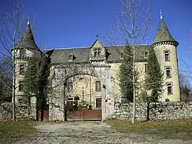 The entrance to the chateau in Bessonies | |
Location of Bessonies | |
 Bessonies  Bessonies | |
| Coordinates: 44°48′40″N 2°09′05″E / 44.8111°N 2.1514°E | |
| Country | France |
| Region | Occitania |
| Department | Lot |
| Arrondissement | Figeac |
| Canton | Lacapelle-Marival |
| Government | |
| • Mayor (2020–2026) | Francis Thers[1] |
| Area 1 | 7.41 km2 (2.86 sq mi) |
| Population | 74 |
| • Density | 10.0/km2 (26/sq mi) |
| Time zone | UTC+01:00 (CET) |
| • Summer (DST) | UTC+02:00 (CEST) |
| INSEE/Postal code | 46338 /46210 |
| Elevation | 510–682 m (1,673–2,238 ft) (avg. 520 m or 1,710 ft) |
| 1 French Land Register data, which excludes lakes, ponds, glaciers > 1 km2 (0.386 sq mi or 247 acres) and river estuaries. | |
Bessonies (French pronunciation: [bɛsɔni]; Occitan: Bessoniás) is a commune in the Lot department in southwestern France.
Population
| Year | Pop. | ±% p.a. |
|---|---|---|
| 1968 | 184 | — |
| 1975 | 169 | −1.21% |
| 1982 | 143 | −2.36% |
| 1990 | 124 | −1.77% |
| 1999 | 120 | −0.36% |
| 2009 | 103 | −1.52% |
| 2014 | 88 | −3.10% |
| 2020 | 75 | −2.63% |
| Source: INSEE[3] | ||
See also
References
- ↑ "Répertoire national des élus: les maires". data.gouv.fr, Plateforme ouverte des données publiques françaises (in French). 2 December 2020.
- ↑ "Populations légales 2021". The National Institute of Statistics and Economic Studies. 28 December 2023.
- ↑ Population en historique depuis 1968, INSEE
Wikimedia Commons has media related to Bessonies.
This article is issued from Wikipedia. The text is licensed under Creative Commons - Attribution - Sharealike. Additional terms may apply for the media files.