Bodrogkisfalud | |
|---|---|
Village | |
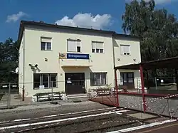 Bodrogkeresztúr railway station | |
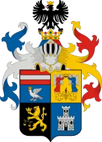
 Flag  Coat of arms | |
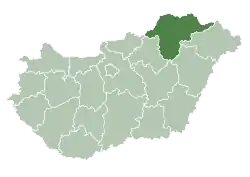
 Bodrogkisfalud Location of Bodrogkisfalud | |
| Coordinates: 48°10′20″N 21°21′16″E / 48.17215°N 21.35453°E | |
| Country | Hungary |
| Region | Northern Hungary |
| County | Borsod-Abaúj-Zemplén |
| District | Tokaj |
| Area | |
| • Total | 14.68 km2 (5.67 sq mi) |
| Population (1 January 2023)[1] | |
| • Total | 781 |
| • Density | 53/km2 (140/sq mi) |
| Time zone | UTC+1 (CET) |
| • Summer (DST) | UTC+2 (CEST) |
| Postal code | 3917 |
| Area code | (+36) 47 |
| Website | www |
Bodrogkisfalud is a village in Borsod-Abaúj-Zemplén county, Hungary.
It was first mentioned under the name Kysfalud in a source dating to 1220.[2] Its primary industry is viticulture.[3] The current mayor, as of May 2021, is Sándor Balogh.[4]
The village has a neo-Romanesque Roman Catholic church built in 1930, consecrated in honour of St Anne. There was no church building in the town until 1772, when the Jesuits consecrated a small chapel there. A full church was built in 1810, but by 1929 had reached such a state of disrepair that it had to be demolished, to be replaced by the current building.[5]
It also features a bust of György Klapka by Gyula Alpár Veres, and a 1896 monument to the 1848/1849 Hungarian Revolution.
Bodrogkisfalud had a significant Jewish population from the 18th century until the Second World War, when it was deported by the Nazis; very few returned.[5]
References
- ↑ Error: Unable to display the reference properly. See the documentation for details.
- ↑ "Bodrogkisfalud". www.bodrogkisfalud.hu. Retrieved 2 May 2021.
- ↑ "Bodrogkisfalud". www.bodrogkisfalud.hu. Retrieved 2 May 2021.
- ↑ "Bodrogkisfalud". www.bodrogkisfalud.hu. Retrieved 2 May 2021.
- 1 2 "Bodrogkisfalud". www.bodrogkisfalud.hu. Retrieved 2 May 2021.
External links
- Street map (in Hungarian)