Burnett, Wisconsin | |
|---|---|
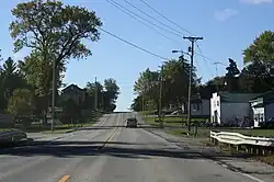 Looking south in Burnett on WIS 26 | |
 Burnett | |
| Coordinates: 43°30′17″N 88°42′25″W / 43.50472°N 88.70694°W | |
| Country | United States |
| State | Wisconsin |
| County | Dodge |
| Town | Burnett |
| Area | |
| • Total | 0.250 sq mi (0.65 km2) |
| • Land | 0.250 sq mi (0.65 km2) |
| • Water | 0 sq mi (0 km2) |
| Elevation | 873 ft (266 m) |
| Population (2010) | |
| • Total | 256 |
| • Density | 1,000/sq mi (400/km2) |
| Time zone | UTC-6 (Central (CST)) |
| • Summer (DST) | UTC-5 (CDT) |
| ZIP code | 53922 |
| Area code | 920 |
| GNIS feature ID | 1562430[1] |
Burnett is an unincorporated census-designated place located in the town of Burnett, Dodge County, Wisconsin, United States. Burnett is located on Wisconsin Highway 26 5.5 miles (8.9 km) northwest of Horicon. Burnett has a post office with ZIP code 53922.[2] As of the 2010 census, its population is 256.[3]
Images
 Looking south at Burnett sign
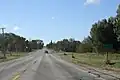
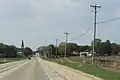 Panorama of Burnett looking north on WIS 26
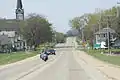 Looking north at Burnett sign
References
Wikimedia Commons has media related to Burnett, Wisconsin.
- ↑ U.S. Geological Survey Geographic Names Information System: Burnett (CDP), Wisconsin
- ↑ ZIP Code Lookup Archived June 15, 2011, at the Wayback Machine
- ↑ "U.S. Census website". U.S. Census Bureau. Retrieved March 29, 2011.
Municipalities and communities of Dodge County, Wisconsin, United States | ||
|---|---|---|
| Cities | 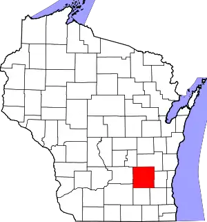 | |
| Villages | ||
| Towns | ||
| CDPs | ||
| Other communities |
| |
| Ghost towns | ||
| Footnotes | ‡This populated place also has portions in an adjacent county or counties | |
This article is issued from Wikipedia. The text is licensed under Creative Commons - Attribution - Sharealike. Additional terms may apply for the media files.