Canehan | |
|---|---|
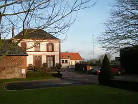 The town hall in Canehan | |
.svg.png.webp) Coat of arms | |
Location of Canehan | |
 Canehan  Canehan | |
| Coordinates: 49°58′40″N 1°20′40″E / 49.9778°N 1.3444°E | |
| Country | France |
| Region | Normandy |
| Department | Seine-Maritime |
| Arrondissement | Dieppe |
| Canton | Eu |
| Intercommunality | CC Falaises du Talou |
| Government | |
| • Mayor (2020–2026) | Daniel Papin[1] |
| Area 1 | 6.18 km2 (2.39 sq mi) |
| Population | 381 |
| • Density | 62/km2 (160/sq mi) |
| Time zone | UTC+01:00 (CET) |
| • Summer (DST) | UTC+02:00 (CEST) |
| INSEE/Postal code | 76155 /76260 |
| Elevation | 16–119 m (52–390 ft) (avg. 100 m or 330 ft) |
| 1 French Land Register data, which excludes lakes, ponds, glaciers > 1 km2 (0.386 sq mi or 247 acres) and river estuaries. | |
Canehan is a commune in the Seine-Maritime department in the Normandy region in northern France.
Geography
A farming village situated in the Pays de Caux, some 16 miles (26 km) northeast of Dieppe, at the junction of the D226 and the D113 roads.
Population
| Year | Pop. | ±% p.a. |
|---|---|---|
| 1968 | 263 | — |
| 1975 | 245 | −1.01% |
| 1982 | 289 | +2.39% |
| 1990 | 322 | +1.36% |
| 1999 | 306 | −0.56% |
| 2007 | 317 | +0.44% |
| 2012 | 324 | +0.44% |
| 2017 | 364 | +2.36% |
| Source: INSEE[3] | ||
Places of interest
- The church of St.Martin, dating from the twelfth century.
See also
References
- ↑ "Répertoire national des élus: les maires" (in French). data.gouv.fr, Plateforme ouverte des données publiques françaises. 13 September 2022.
- ↑ "Populations légales 2021". The National Institute of Statistics and Economic Studies. 28 December 2023.
- ↑ Population en historique depuis 1968, INSEE
Wikimedia Commons has media related to Canehan.
This article is issued from Wikipedia. The text is licensed under Creative Commons - Attribution - Sharealike. Additional terms may apply for the media files.