Raffetot | |
|---|---|
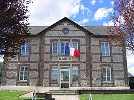 The town hall in Raffetot | |
Location of Raffetot | |
 Raffetot  Raffetot | |
| Coordinates: 49°36′03″N 0°30′55″E / 49.6008°N 0.5153°E | |
| Country | France |
| Region | Normandy |
| Department | Seine-Maritime |
| Arrondissement | Le Havre |
| Canton | Bolbec |
| Intercommunality | Caux Seine Agglo |
| Government | |
| • Mayor (2020–2026) | Bruno Cadiou[1] |
| Area 1 | 6.85 km2 (2.64 sq mi) |
| Population | 498 |
| • Density | 73/km2 (190/sq mi) |
| Time zone | UTC+01:00 (CET) |
| • Summer (DST) | UTC+02:00 (CEST) |
| INSEE/Postal code | 76518 /76210 |
| Elevation | 127–144 m (417–472 ft) (avg. 136 m or 446 ft) |
| 1 French Land Register data, which excludes lakes, ponds, glaciers > 1 km2 (0.386 sq mi or 247 acres) and river estuaries. | |
Raffetot (French pronunciation: [ʁafto]) is a commune in the Seine-Maritime department in the Normandy region in northern France.
Geography
A farming village in the Pays de Caux, situated some 21 miles (34 km) northeast of Le Havre, sandwiched between the D30 road and the A29 autoroute.
Population
| Year | Pop. | ±% p.a. |
|---|---|---|
| 1968 | 399 | — |
| 1975 | 373 | −0.96% |
| 1982 | 427 | +1.95% |
| 1990 | 467 | +1.13% |
| 1999 | 475 | +0.19% |
| 2007 | 457 | −0.48% |
| 2012 | 498 | +1.73% |
| 2017 | 503 | +0.20% |
| Source: INSEE[3] | ||
Places of interest
- The church of St. Anne, dating from the thirteenth century.
See also
References
- ↑ Liste des maires du département de la Seine-Maritime, 10 August 2020
- ↑ "Populations légales 2021". The National Institute of Statistics and Economic Studies. 28 December 2023.
- ↑ Population en historique depuis 1968, INSEE
Wikimedia Commons has media related to Raffetot.
This article is issued from Wikipedia. The text is licensed under Creative Commons - Attribution - Sharealike. Additional terms may apply for the media files.