Castiglione Messer Raimondo | |
|---|---|
| Comune di Castiglione Messer Raimondo | |
 Coat of arms | |
Location of Castiglione Messer Raimondo | |
 Castiglione Messer Raimondo Location of Castiglione Messer Raimondo in Italy 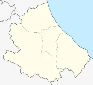 Castiglione Messer Raimondo Castiglione Messer Raimondo (Abruzzo) | |
| Coordinates: 42°32′N 13°53′E / 42.533°N 13.883°E | |
| Country | Italy |
| Region | Abruzzo |
| Province | Teramo (TE) |
| Frazioni | Appignano, Borea Santa Maria, Bozzano, Cesi, Colletrimarino, Piane, San Giorgio, Vorghe |
| Government | |
| • Mayor | Danilo Crescia |
| Area | |
| • Total | 30 km2 (10 sq mi) |
| Elevation | 306 m (1,004 ft) |
| Population (1 January 2009)[2] | |
| • Total | 2,398 |
| • Density | 80/km2 (210/sq mi) |
| Demonym | Castiglionesi |
| Time zone | UTC+1 (CET) |
| • Summer (DST) | UTC+2 (CEST) |
| Postal code | 64034 |
| Dialing code | 0861 |
| Patron saint | San Donato Martire |
| Saint day | 7 August |
| Website | Official website |
Castiglione Messer Raimondo (locally Castiùne) is a town and comune in the province of Teramo, Abruzzo, central Italy.
It is a medieval borough near the Gran Sasso d'Italia massif. Economy is mostly based on agriculture.
References
- ↑ "Superficie di Comuni Province e Regioni italiane al 9 ottobre 2011". Italian National Institute of Statistics. Retrieved 16 March 2019.
- ↑ All demographics and other statistics from the Italian statistical institute (Istat)
This article is issued from Wikipedia. The text is licensed under Creative Commons - Attribution - Sharealike. Additional terms may apply for the media files.