Châtel-Saint-Germain | |
|---|---|
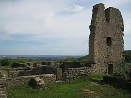 The remains of the priory in Châtel-Saint-Germain | |
.svg.png.webp) Coat of arms | |
Location of Châtel-Saint-Germain | |
 Châtel-Saint-Germain  Châtel-Saint-Germain | |
| Coordinates: 49°07′28″N 6°04′49″E / 49.1244°N 6.0803°E | |
| Country | France |
| Region | Grand Est |
| Department | Moselle |
| Arrondissement | Metz |
| Canton | Les Coteaux de Moselle |
| Intercommunality | Metz Métropole |
| Government | |
| • Mayor (2020–2026) | Claire Ancel[1] |
| Area 1 | 12.88 km2 (4.97 sq mi) |
| Population | 1,892 |
| • Density | 150/km2 (380/sq mi) |
| Time zone | UTC+01:00 (CET) |
| • Summer (DST) | UTC+02:00 (CEST) |
| INSEE/Postal code | 57134 /57160 |
| Elevation | 176–355 m (577–1,165 ft) (avg. 200 m or 660 ft) |
| 1 French Land Register data, which excludes lakes, ponds, glaciers > 1 km2 (0.386 sq mi or 247 acres) and river estuaries. | |
Châtel-Saint-Germain (French: [ʃɑtɛl sɛ̃ ʒɛʁmɛ̃]; German: Sankt German, (1941-1944) Germannsburg) is a commune in the Moselle department in Grand Est in north-eastern France.
It is situated at the foot of Mount Saint-Germain, which was formerly a strategic location overlooking the Paris-Metz road. The area has been occupied since the Neolithic period.
See also
References
- ↑ "Répertoire national des élus: les maires" (in French). data.gouv.fr, Plateforme ouverte des données publiques françaises. 13 September 2022.
- ↑ "Populations légales 2021". The National Institute of Statistics and Economic Studies. 28 December 2023.
External links
 Media related to Châtel-Saint-Germain at Wikimedia Commons
This article is issued from Wikipedia. The text is licensed under Creative Commons - Attribution - Sharealike. Additional terms may apply for the media files.