Rémelfang | |
|---|---|
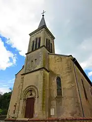 The church in Rémelfang | |
 Coat of arms | |
Location of Rémelfang | |
 Rémelfang  Rémelfang | |
| Coordinates: 49°16′17″N 6°30′38″E / 49.2714°N 6.5106°E | |
| Country | France |
| Region | Grand Est |
| Department | Moselle |
| Arrondissement | Forbach-Boulay-Moselle |
| Canton | Bouzonville |
| Intercommunality | Bouzonvillois - Trois Frontières |
| Government | |
| • Mayor (2020–2026) | Alphonse Masson[1] |
| Area 1 | 3.3 km2 (1.3 sq mi) |
| Population | 145 |
| • Density | 44/km2 (110/sq mi) |
| Time zone | UTC+01:00 (CET) |
| • Summer (DST) | UTC+02:00 (CEST) |
| INSEE/Postal code | 57567 /57320 |
| Elevation | 195–301 m (640–988 ft) (avg. 210 m or 690 ft) |
| 1 French Land Register data, which excludes lakes, ponds, glaciers > 1 km2 (0.386 sq mi or 247 acres) and river estuaries. | |
Rémelfang (German: Remelfangen) is a commune in the Moselle department in Grand Est in north-eastern France.
Geography
It is located in the Rhine catchment area and is drained by the Bettange stream and the Esbach stream.[3]
See also
References
- ↑ "Répertoire national des élus: les maires". data.gouv.fr, Plateforme ouverte des données publiques françaises (in French). 2 December 2020.
- ↑ "Populations légales 2021". The National Institute of Statistics and Economic Studies. 28 December 2023.
- ↑ "Géoportail". www.geoportail.gouv.fr. Retrieved 26 October 2023.
External links
 Media related to Rémelfang at Wikimedia Commons
This article is issued from Wikipedia. The text is licensed under Creative Commons - Attribution - Sharealike. Additional terms may apply for the media files.