Dévaványa | |
|---|---|
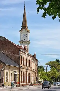 The northern side of the main street in Dévaványa | |
 Flag  Coat of arms | |
 Dévaványa | |
| Coordinates: 47°01′48″N 20°57′32″E / 47.030°N 20.959°E | |
| Country | |
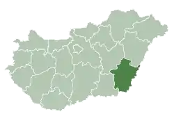
| County | Békés |
| District | Gyomaendrőd |
| Area | |
| • Total | 216.73 km2 (83.68 sq mi) |
| Population (2008) | |
| • Total | 8,273 |
| • Density | 41.04/km2 (106.3/sq mi) |
| Time zone | UTC+1 (CET) |
| • Summer (DST) | UTC+2 (CEST) |
| Postal code | 5510 |
| Area code | (+36) 66 |
| Website | www |
Dévaványa is a town in northern Békés county, in the Southern Great Plain region of Hungary.
Geography
It covers an area of 216.73 km² and has a population of 8273 people (2008).
Twin towns – sister cities
Dévaványa is twinned with:
 Cristuru Secuiesc, Romania (1994)
External links
Wikimedia Commons has media related to Dévaványa.
- Official website in Hungarian
| Towns (2) |
| |
|---|---|---|
| Villages (3) | ||
| City with county rights |
|   |
|---|---|---|
| Towns | ||
| Large villages | ||
| Villages |
| |
| Other topics |
| |
47°02′N 20°58′E / 47.033°N 20.967°E
This article is issued from Wikipedia. The text is licensed under Creative Commons - Attribution - Sharealike. Additional terms may apply for the media files.