Ferrell, West Virginia | |
|---|---|
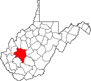
 Ferrell Location within West Virginia and the United States  Ferrell Ferrell (the United States) | |
| Coordinates: 38°21′10″N 81°50′00″W / 38.35278°N 81.83333°W | |
| Country | United States |
| State | West Virginia |
| County | Kanawha |
| Elevation | 604 ft (184 m) |
| Time zone | UTC-5 (Eastern (EST)) |
| • Summer (DST) | UTC-4 (EDT) |
| ZIP code | 25177 |
| Area code(s) | 304 & 681 |
| GNIS ID | 1554451[1] |
Ferrell is an unincorporated area in Kanawha County, West Virginia, United States.
The community was part of the Upper Falls census-designated place from 2010 until 2020.[2][3]
Residents receive mail using the city name Saint Albans at ZIP Code 25177.[4]
Ferrell is in the Charleston, West Virginia metropolitan area.
References
- ↑ U.S. Geological Survey Geographic Names Information System: Ferrell, West Virginia
- ↑ Map of 2010 Upper Falls CDP, Upper Falls, West Virginia
- ↑ 2020 Tornado CDP, U.S. Census Bureau
- ↑ Saint Albans, West Virginia ZIP Code Map, Home Town Locator
This article is issued from Wikipedia. The text is licensed under Creative Commons - Attribution - Sharealike. Additional terms may apply for the media files.