Forcalqueiret | |
|---|---|
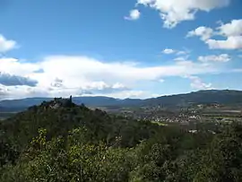 A general view of Forcalqueiret from the west | |
.svg.png.webp) Coat of arms | |
Location of Forcalqueiret | |
 Forcalqueiret 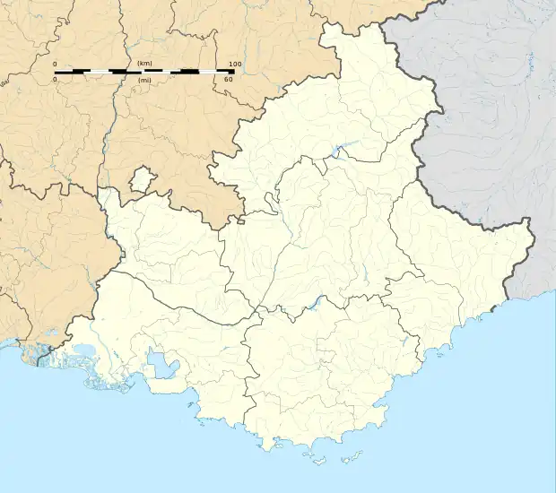 Forcalqueiret | |
| Coordinates: 43°20′14″N 6°04′53″E / 43.3372°N 6.0814°E | |
| Country | France |
| Region | Provence-Alpes-Côte d'Azur |
| Department | Var |
| Arrondissement | Brignoles |
| Canton | Garéoult |
| Intercommunality | CA Provence Verte |
| Government | |
| • Mayor (2020–2026) | Gilbert Bringant[1] |
| Area 1 | 10.33 km2 (3.99 sq mi) |
| Population | 3,269 |
| • Density | 320/km2 (820/sq mi) |
| Time zone | UTC+01:00 (CET) |
| • Summer (DST) | UTC+02:00 (CEST) |
| INSEE/Postal code | 83059 /83136 |
| Elevation | 284–528 m (932–1,732 ft) (avg. 296 m or 971 ft) |
| 1 French Land Register data, which excludes lakes, ponds, glaciers > 1 km2 (0.386 sq mi or 247 acres) and river estuaries. | |
Forcalqueiret (French pronunciation: [fɔʁkalkɛʁɛ]; Occitan: Forcauqueiret) is a commune in the Var department in the Provence-Alpes-Côte d'Azur region in southeastern France.
Population
| Year | Pop. | ±% p.a. |
|---|---|---|
| 1968 | 215 | — |
| 1975 | 315 | +5.61% |
| 1982 | 744 | +13.06% |
| 1990 | 1,313 | +7.36% |
| 1999 | 1,665 | +2.67% |
| 2007 | 2,083 | +2.84% |
| 2012 | 2,632 | +4.79% |
| 2017 | 2,990 | +2.58% |
| Source: INSEE[3] | ||
See also
References
- ↑ "Répertoire national des élus: les maires" (in French). data.gouv.fr, Plateforme ouverte des données publiques françaises. 13 September 2022.
- ↑ "Populations légales 2021". The National Institute of Statistics and Economic Studies. 28 December 2023.
- ↑ Population en historique depuis 1968, INSEE
Wikimedia Commons has media related to Forcalqueiret.
This article is issued from Wikipedia. The text is licensed under Creative Commons - Attribution - Sharealike. Additional terms may apply for the media files.