Rocbaron | |
|---|---|
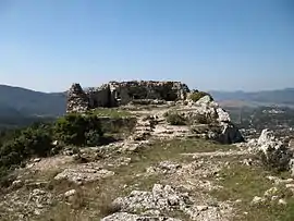 Ruins of St Sauveur Castle, in Rocbaron | |
.svg.png.webp) Coat of arms | |
Location of Rocbaron | |
 Rocbaron 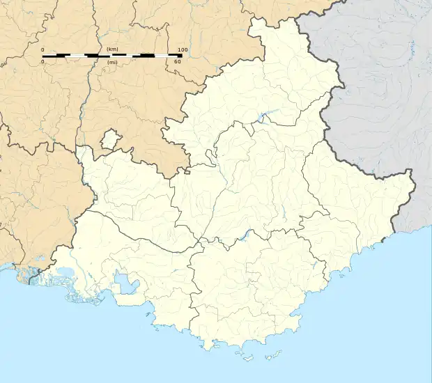 Rocbaron | |
| Coordinates: 43°18′18″N 6°05′30″E / 43.305°N 6.0917°E | |
| Country | France |
| Region | Provence-Alpes-Côte d'Azur |
| Department | Var |
| Arrondissement | Brignoles |
| Canton | Garéoult |
| Intercommunality | CA Provence Verte |
| Government | |
| • Mayor (2020–2026) | Jean-Claude Felix[1] |
| Area 1 | 20.28 km2 (7.83 sq mi) |
| Population | 5,422 |
| • Density | 270/km2 (690/sq mi) |
| Time zone | UTC+01:00 (CET) |
| • Summer (DST) | UTC+02:00 (CEST) |
| INSEE/Postal code | 83106 /83136 |
| Elevation | 272–592 m (892–1,942 ft) (avg. 370 m or 1,210 ft) |
| 1 French Land Register data, which excludes lakes, ponds, glaciers > 1 km2 (0.386 sq mi or 247 acres) and river estuaries. | |
Rocbaron (French pronunciation: [ʁɔkbaʁɔ̃]; Occitan: Ròcbaron) is a commune in the Var department in the Provence-Alpes-Côte d'Azur region in southeastern France.
Population
| Year | Pop. | ±% p.a. |
|---|---|---|
| 1968 | 222 | — |
| 1975 | 310 | +4.89% |
| 1982 | 778 | +14.05% |
| 1990 | 1,774 | +10.85% |
| 1999 | 3,026 | +6.11% |
| 2007 | 3,361 | +1.32% |
| 2012 | 4,059 | +3.85% |
| 2017 | 5,033 | +4.40% |
| Source: INSEE[3] | ||
See also
References
- ↑ "Répertoire national des élus: les maires". data.gouv.fr, Plateforme ouverte des données publiques françaises (in French). 2 December 2020.
- ↑ "Populations légales 2021". The National Institute of Statistics and Economic Studies. 28 December 2023.
- ↑ Population en historique depuis 1968, INSEE
Wikimedia Commons has media related to Rocbaron.
This article is issued from Wikipedia. The text is licensed under Creative Commons - Attribution - Sharealike. Additional terms may apply for the media files.