Habrůvka | |
|---|---|
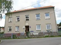 Municipal office | |
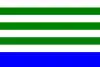 Flag  Coat of arms | |
 Habrůvka Location in the Czech Republic | |
| Coordinates: 49°18′13″N 16°43′25″E / 49.30361°N 16.72361°E | |
| Country | |
| Region | South Moravian |
| District | Blansko |
| First mentioned | 1365 |
| Area | |
| • Total | 9.95 km2 (3.84 sq mi) |
| Elevation | 490 m (1,610 ft) |
| Population (2023-01-01)[1] | |
| • Total | 423 |
| • Density | 43/km2 (110/sq mi) |
| Time zone | UTC+1 (CET) |
| • Summer (DST) | UTC+2 (CEST) |
| Postal code | 679 05 |
| Website | www |
Habrůvka is a municipality and village in Blansko District in the South Moravian Region of the Czech Republic. It has about 400 inhabitants.
Habrůvka lies approximately 9 kilometres (6 mi) south-east of Blansko, 14 km (9 mi) north-east of Brno, and 187 km (116 mi) south-east of Prague.
References
Wikimedia Commons has media related to Habrůvka.
This article is issued from Wikipedia. The text is licensed under Creative Commons - Attribution - Sharealike. Additional terms may apply for the media files.