Hoadley | |
|---|---|
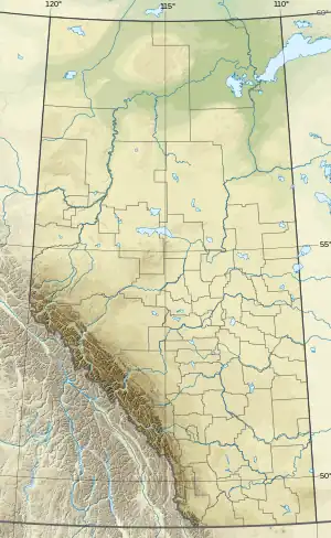 Hoadley Location of Hoadley  Hoadley Hoadley (Canada) | |
| Coordinates: 52°50′49″N 114°22′21″W / 52.84694°N 114.37250°W | |
| Country | Canada |
| Province | Alberta |
| Region | Central Alberta |
| Census division | 8 |
| Municipal district | Ponoka County |
| Government | |
| • Type | Unincorporated |
| • Governing body | Ponoka County Council |
| Population (1991)[1] | |
| • Total | 9 |
| Time zone | UTC−07:00 (MST) |
| • Summer (DST) | UTC−06:00 (MDT) |
| Area code(s) | 403, 587, 825 |
Hoadley is a hamlet in central Alberta, Canada within Ponoka County.[2] It is located on Highway 20, approximately 69 kilometres (43 mi) west of Wetaskiwin.
History
The community name was established as a watering stop on the now defunct Lacombe and Blindman Valley Electric Railway[3] –built in 1917–19. It was named after George Hoadley Member of the Legislative Assembly of Alberta from 1909 to 1930.[4]
Demographics
Hoadley recorded a population of 9 in the 1991 Census of Population conducted by Statistics Canada.[1]
See also
References
- 1 2 "91 Census: Unincorporated Places — Population and Dwelling Counts" (PDF). Statistics Canada. June 1993. Retrieved September 25, 2021.
- ↑ "Specialized and Rural Municipalities and Their Communities" (PDF). Alberta Municipal Affairs. January 12, 2022. Retrieved January 21, 2022.
- ↑ "Lacombe & Blindman Valley Electric Railway - CPR - Historical Perspective - Forth Junction". forthjunction.ca. Retrieved May 7, 2019.
- ↑ Mardon, Ernest G; Austin (2010). Community names of Alberta. Lulu.com. p. 181. ISBN 978-1897472170.
{{cite book}}: CS1 maint: multiple names: authors list (link)
This article is issued from Wikipedia. The text is licensed under Creative Commons - Attribution - Sharealike. Additional terms may apply for the media files.