| Holcot | |
|---|---|
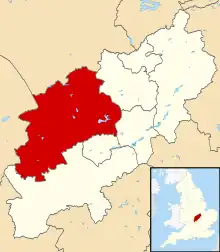
.svg.png.webp) Holcot Location within Northamptonshire | |
| Population | 438 |
| OS grid reference | SP7969 |
| Unitary authority | |
| Ceremonial county | |
| Region | |
| Country | England |
| Sovereign state | United Kingdom |
| Post town | Northampton |
| Postcode district | NN6 |
| Dialling code | 01604 |
| Police | Northamptonshire |
| Fire | Northamptonshire |
| Ambulance | East Midlands |
| UK Parliament | |
Holcot is a village and civil parish in the West Northamptonshire in England. At the time of the 2001 census, the parish's population was 399 people.[1] At the 2011 census this had increased to 438 people, living in 182 households.[2][3]
The villages name means 'Cottages in the hollows'.[4]
Notable buildings
The Historic England website contains details of a total of ten listed buildings in the parish of Holcot, all of which are Grade II except for St Mary and All Saints’ Church which is Grade I.[5] They are:
- St Mary and All Saints' Church, Main Street
- Polly's Cottage, Back Lane
- War Memorial, Back Lane
- The Old Rectory, Brixworth Road
- Churchyard Cross, Main Street
- Hollybush Farmhouse, Poplar Lane
- Poplar Farm, Poplar Lane
- Manor House, Rectory Lane
- Brook Cottage & Wall Dene, Sywell Road
- Ivy House, Sywell Road
See also
- Robert Holcot (born in Holcot)
References
- ↑ Office for National Statistics: Holcot CP: Parish headcounts. Retrieved 12 November 2009
- ↑ 2011 census
- ↑ "Check Browser Settings". Archived from the original on 24 December 2015.
- ↑ "Key to English Place-names".
- ↑ "Historic England – The List". Retrieved 18 September 2015.
External links
![]() Media related to Holcot at Wikimedia Commons
Media related to Holcot at Wikimedia Commons
Village website http://www.holcotvillage.co.uk
This article is issued from Wikipedia. The text is licensed under Creative Commons - Attribution - Sharealike. Additional terms may apply for the media files.