| Teeton | |
|---|---|
 | |
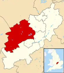
.svg.png.webp) Teeton Location within Northamptonshire | |
| Population | 50 |
| OS grid reference | SP6970 |
| Unitary authority | |
| Ceremonial county | |
| Region | |
| Country | England |
| Sovereign state | United Kingdom |
| Post town | Northampton |
| Postcode district | NN6 |
| Dialling code | 01604 |
| Police | Northamptonshire |
| Fire | Northamptonshire |
| Ambulance | East Midlands |
| UK Parliament | |
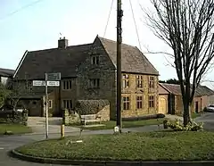
Teeton is a village and former civil parish, now in the parish of Hollowell, in the West Northamptonshire district, in the ceremonial county of Northamptonshire, England. In 1931 the parish had a population of 55.[1] In 1866 Teeton became a civil parish, on 1 April 1935 the parish was abolished and merged with Hollowell.[2]
The village's name means 'Beacon'. The village is situated on the end of a ridge.[3]
References
- ↑ "Population statistics Teeton Hmlt/CP through time". A Vision of Britain through Time. Retrieved 27 March 2023.
- ↑ "Relationships and changes Teeton Hmlt/CP through time". A Vision of Britain through Time. Retrieved 27 March 2023.
- ↑ "Key to English Place-names".
External links
![]() Media related to Teeton at Wikimedia Commons
Media related to Teeton at Wikimedia Commons
- Map sources for Teeton
This article is issued from Wikipedia. The text is licensed under Creative Commons - Attribution - Sharealike. Additional terms may apply for the media files.