Klempau | |
|---|---|
 Flag  Coat of arms | |
Location of Klempau within Herzogtum Lauenburg district 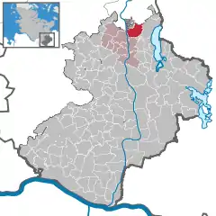 | |
 Klempau 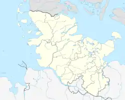 Klempau | |
| Coordinates: 53°46′N 10°40′E / 53.767°N 10.667°E | |
| Country | Germany |
| State | Schleswig-Holstein |
| District | Herzogtum Lauenburg |
| Municipal assoc. | Berkenthin |
| Government | |
| • Mayor | Karl Bartels |
| Area | |
| • Total | 10.07 km2 (3.89 sq mi) |
| Elevation | 15 m (49 ft) |
| Population (2022-12-31)[1] | |
| • Total | 597 |
| • Density | 59/km2 (150/sq mi) |
| Time zone | UTC+01:00 (CET) |
| • Summer (DST) | UTC+02:00 (CEST) |
| Postal codes | 23628 |
| Dialling codes | 04508 |
| Vehicle registration | RZ |
| Website | www.amt- berkenthin.de |
Klempau is a municipality in the district of Lauenburg, in Schleswig-Holstein, Germany. It is located south of the city of Lübeck and west of Ratzeburger See.
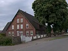
5 Dorfstrasse
References
Wikimedia Commons has media related to Klempau.
This article is issued from Wikipedia. The text is licensed under Creative Commons - Attribution - Sharealike. Additional terms may apply for the media files.