Klondike, Wisconsin | |
|---|---|
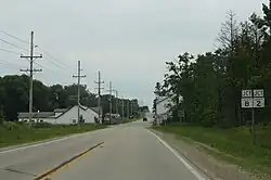 Looking south at Klondike | |
 Klondike, Wisconsin  Klondike, Wisconsin | |
| Coordinates: 45°04′05″N 88°09′35″W / 45.06806°N 88.15972°W | |
| Country | |
| State | |
| County | Oconto |
| Elevation | 241 m (791 ft) |
| Time zone | UTC-6 (Central (CST)) |
| • Summer (DST) | UTC-5 (CDT) |
| Area code | 920 |
| GNIS feature ID | 1567553[1] |
Klondike is an unincorporated community in Oconto County, Wisconsin, United States.[1][2] The community is located at the intersection of Oconto County Highways ZZ, B, and Z, in the town of Brazeau, Wisconsin. It is located at latitude 45.068 and longitude -88.16 at an elevation of 791 feet (mean sea level).[2]
Images
 Panorama of Klondike looking west
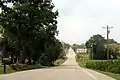
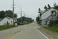 Looking south at downtown Klondike
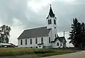 Klondike Community Church
Notes
Wikimedia Commons has media related to Klondike, Oconto County, Wisconsin.
Municipalities and communities of Oconto County, Wisconsin, United States | ||
|---|---|---|
| Cities | 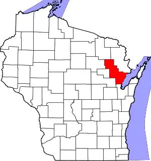 | |
| Villages | ||
| Towns | ||
| CDPs | ||
| Other communities | ||
| Indian reservation | ||
| Footnotes | ‡This populated place also has portions in an adjacent county or counties | |
45°04′05″N 88°09′35″W / 45.06806°N 88.15972°W
This article is issued from Wikipedia. The text is licensed under Creative Commons - Attribution - Sharealike. Additional terms may apply for the media files.