Kohtla-Nõmme | |
|---|---|
Borough with a municipality status | |
 | |
 Flag  Coat of arms | |
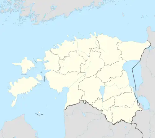 Kohtla-Nõmme Location in Estonia | |
| Coordinates: 59°21′14″N 27°11′31″E / 59.35389°N 27.19194°E | |
| Country | Estonia |
| County | Ida-Viru County |
| Municipaity | Toila Parish |
| Area | |
| • Total | 4.64 km2 (1.79 sq mi) |
| Population (01.01.2009) | |
| • Total | 1,047 |
| • Density | 230/km2 (580/sq mi) |
Kohtla-Nõmme is a borough (Estonian: alev) in Toila Parish, in Ida-Viru County, in northeastern Estonia. It had a population of 1,047 (as of 1 January 2009) and an area of 4.64 km².[1]
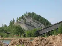
In 1930s New Consolidated Gold Fields opened a shale oil extraction complex at Kohtla-Nõmme. In 1937, the company opened the Kohtla underground mine. After the occupation of Estonia by the Soviet Union, the company was nationalized in 1940. The Kohtla-Nõmme shale oil extraction complex continued to operate until 1961. The underground mine stayed operational until 2001.[2] After that the Estonian Mining Museum was opened at the site.
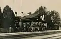 Kohtla railway station that was destroyed in WWII
.jpg.webp) Kohtla Mine in 1994
Kohtla Mine in 1994 360° panorama of the Estonian Mining Museum
See also
References
- ↑ "Population figure and composition". stat.ee – Statistics Estonia. Retrieved 29 January 2010.
- ↑ Karu, Veiko; Valgma, Ingo; Kolats, Margit (2013). "Mine water as a potential source of energy from underground mined area in Estonian oil shale deposit" (PDF). Oil Shale. A Scientific-Technical Journal. Estonian Academy Publishers. 30 (2S): 336–362. doi:10.3176/oil.2013.2S.12. ISSN 0208-189X. Retrieved 2014-04-12.
External links
| Borough |  | |
|---|---|---|
| Small boroughs | ||
| Villages | ||
This article is issued from Wikipedia. The text is licensed under Creative Commons - Attribution - Sharealike. Additional terms may apply for the media files.