Kunlong
ကွမ်းလုံမြို့နယ် | |
|---|---|
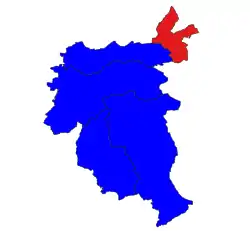 Location in Lashio district | |
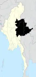
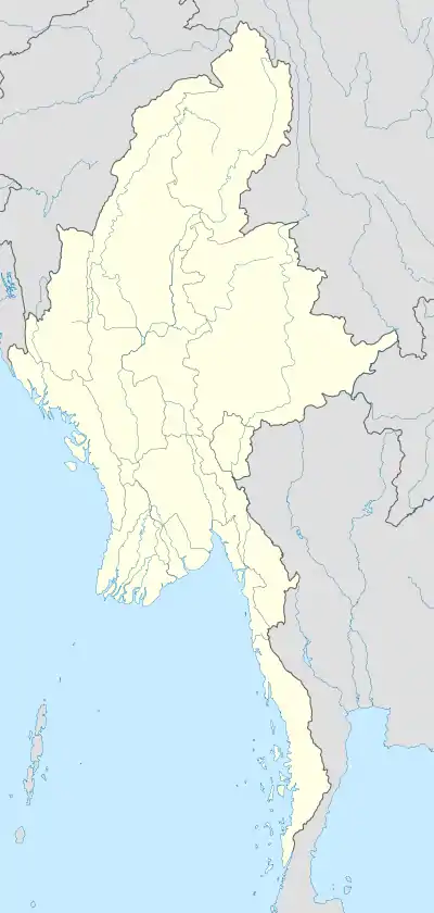 Kunlong Location in Myanmar | |
| Coordinates: 23°25′20″N 98°39′10″E / 23.42222°N 98.65278°E | |
| Country | |
| State | Shan State |
| District | Lashio District |
| Area | |
| • Total | 379.39 sq mi (982.62 km2) |
| Elevation | 1,413 ft (431 m) |
| Highest elevation | 7,171 ft (2,186 m) |
| Population (2019)[1] | |
| • Total | 56,304 |
| • Density | 150/sq mi (57/km2) |
| • Ethnicities | |
| • Religions |
|
| Time zone | UTC+6.30 (MST) |
Kunlong Township is a township of Lashio District (formerly part of Kunlong District) in Shan State, Burma. The main town is Kunlong, located by the Salween River.
55% of the township identified as "Other religion" as of 2019 General Administration Department data, being noted as not Buddhist or Burmese folk religion.[1]
Further reading
References
- 1 2 3 Myanmar Information Management Unit (2019). Kunlong Myone Daethasaingyarachatlatmya ကွမ်းလုံမြို့နယ် ဒေသဆိုင်ရာအချက်လက်များ [Kunlong Township Regional Information] (PDF) (Report) (in Burmese).

This article is issued from Wikipedia. The text is licensed under Creative Commons - Attribution - Sharealike. Additional terms may apply for the media files.