Kyadet
ကျားတတ[1] Kyatat[1] | |
|---|---|
Town | |
 Kyadet Location in Burma | |
| Coordinates: 21°50′50″N 94°56′05″E / 21.84722°N 94.93472°E | |
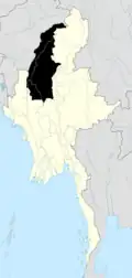
| Country | |
| Region | |
| District | Monywa District |
| Township | Salingyi Township |
| Elevation | 126 m (413 ft) |
| Time zone | UTC+6.30 (MST) |
Kyadet is a town[2] in Salingyi Township, Monywa District, in southern Sagaing Region, Myanmar. Kyadet is at a crossroads with one route going north-east to Pale, one running north to Salingyi, and a third running south-east to Lingadaw.
Notes
- 1 2 "Map of Sagaing Division" Archived 2012-09-05 at archive.today Myanmars.net
- ↑ "Kyadet, Myanmar" Geonames.com
External links
.svg.png.webp)
This article is issued from Wikipedia. The text is licensed under Creative Commons - Attribution - Sharealike. Additional terms may apply for the media files.