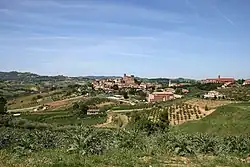
Longiano | |
|---|---|
| Comune di Longiano | |
 | |
Location of Longiano | |
 Longiano Location of Longiano in Italy 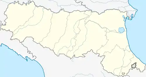 Longiano Longiano (Emilia-Romagna) | |
| Coordinates: 44°4′30″N 12°19′40″E / 44.07500°N 12.32778°E | |
| Country | Italy |
| Region | Emilia-Romagna |
| Province | Province of Forlì-Cesena (FC) |
| Frazioni | Capoluogo, Budrio, Ponte Ospedaletto, Crocetta, Montilgallo, Felloniche, Badia, Massa |
| Area | |
| • Total | 23.6 km2 (9.1 sq mi) |
| Elevation | 169 m (554 ft) |
| Population (Dec. 2004)[2] | |
| • Total | 6,042 |
| • Density | 260/km2 (660/sq mi) |
| Demonym | Longianesi |
| Time zone | UTC+1 (CET) |
| • Summer (DST) | UTC+2 (CEST) |
| Postal code | 47020 |
| Dialing code | 0547 |
| Patron saint | St. Christopher |
| Website | Official website |
Longiano (Romagnol: Lunzèn) is a comune (municipality) in the Province of Forlì-Cesena in the Italian region Emilia-Romagna, located about 90 kilometres (56 mi) southeast of Bologna and about 30 kilometres (19 mi) southeast of Forlì. Longiano borders the following municipalities: Borghi, Cesena, Gambettola, Gatteo, Montiano, Roncofreddo, Santarcangelo di Romagna, Savignano sul Rubicone.
Main sights
- Castello Malatestiano (Castle, 13th century): now houses the Fondazione Tito Balestra, a museum of contemporary and modern art from the region of Emilia Romagna.
- Teatro Petrella (19th century)
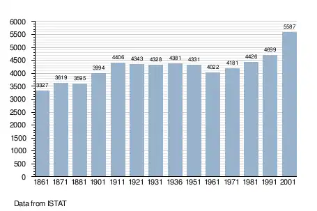
Demographic evolution[3]
References
- ↑ "Superficie di Comuni Province e Regioni italiane al 9 ottobre 2011". Italian National Institute of Statistics. Retrieved 16 March 2019.
- ↑ "Popolazione Residente al 1° Gennaio 2018". Italian National Institute of Statistics. Retrieved 16 March 2019.
- ↑ All demographics and other statistics: Italian statistical institute Istat.
External links
This article is issued from Wikipedia. The text is licensed under Creative Commons - Attribution - Sharealike. Additional terms may apply for the media files.