Macari | |
|---|---|
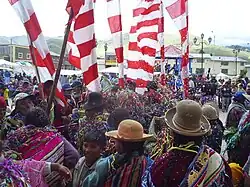 Carnival in Macari | |
| Country | |
| Region | Puno |
| Province | Melgar |
| Capital | Macari |
| Government | |
| • Mayor | Simon Amador Mamani Chañi |
| Area | |
| • Total | 673.78 km2 (260.15 sq mi) |
| Elevation | 3,970 m (13,020 ft) |
| Population | |
| • Total | 8,731 |
| • Density | 13/km2 (34/sq mi) |
| Time zone | UTC-5 (PET) |
| UBIGEO | 210805 |
Macari District is one of nine districts of the Melgar Province in Peru.[1] The capital of the district is Macari.
Limits
- Nort: Layo District
- South: Cupi District
- East: Chuquibambilla
- West: Cusco Department
Geography
One of the highest peaks of the district is Qillqa at 4,900 m (16,100 ft). Other mountains are listed below:[2]
- Apachita
- Aqhuyani
- Chachakumani
- Ch'iqu Rumi
- Hatun Llallawa
- Janq'u Jaqhi
- Kiswarniyuq
- Kuntur Sayana
- Kunturwasa
- Pata Urqu
- Pichaqani
- Puka Apachita
- P'isaq P'unqu
- Qillwa
- Q'illu Qaqa
- Saywani
- Saywanniyuq Urqu
- Surallani
- Tarujani
- Tika Pallana
- Wamanlipani
- Wanqa Sayani
- Waqra Waqra
- Wari Kunka
- Waychu
- Wayna Wachu
- Wila Quta
Ethnic groups
The people in the district are mainly indigenous citizens of Quechua descent. Quechua is the language which the majority of the population (84.25%) learnt to speak in childhood, 15.55% of the residents started speaking using the Spanish language (2007 Peru Census).[3]
References
- ↑ (in Spanish) Instituto Nacional de Estadística e Informática. Banco de Información Distrital Archived 2008-04-23 at the Wayback Machine. Retrieved April 11, 2008.
- ↑ escale.minedu.gob.pe/ UGEL map Melgar Province (Cusco Region)
- ↑ inei.gob.pe Archived 2013-01-27 at the Wayback Machine INEI, Peru, Censos Nacionales 2007, Frequencias: Preguntas de Población: Idioma o lengua con el que aprendió hablar (in Spanish)
| |
|---|---|
| Azángaro | |
| Carabaya | |
| Chucuito | |
| El Collao | |
| Huancané | |
| Lampa | |
| Melgar | |
| Moho | |
| Puno | |
| San Antonio de Putina | |
| San Román | |
| Sandia | |
| Yunguyo | |
This article is issued from Wikipedia. The text is licensed under Creative Commons - Attribution - Sharealike. Additional terms may apply for the media files.