Malzéville | |
|---|---|
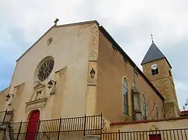 The church in Malzéville | |
.svg.png.webp) Coat of arms | |
Location of Malzéville | |
 Malzéville  Malzéville | |
| Coordinates: 48°42′40″N 6°11′14″E / 48.7111°N 6.1872°E | |
| Country | France |
| Region | Grand Est |
| Department | Meurthe-et-Moselle |
| Arrondissement | Nancy |
| Canton | Saint-Max |
| Intercommunality | Métropole du Grand Nancy |
| Government | |
| • Mayor (2020–2026) | Bertrand Kling[1] |
| Area 1 | 7.53 km2 (2.91 sq mi) |
| Population | 7,927 |
| • Density | 1,100/km2 (2,700/sq mi) |
| Time zone | UTC+01:00 (CET) |
| • Summer (DST) | UTC+02:00 (CEST) |
| INSEE/Postal code | 54339 /54220 |
| Elevation | 187–384 m (614–1,260 ft) (avg. 210 m or 690 ft) |
| 1 French Land Register data, which excludes lakes, ponds, glaciers > 1 km2 (0.386 sq mi or 247 acres) and river estuaries. | |
Malzéville (French pronunciation: [malzevil]) is a commune in the Meurthe-et-Moselle department in north-eastern France.
Population
| Year | Pop. | ±% p.a. |
|---|---|---|
| 1968 | 8,725 | — |
| 1975 | 8,432 | −0.49% |
| 1982 | 8,325 | −0.18% |
| 1990 | 8,090 | −0.36% |
| 1999 | 7,712 | −0.53% |
| 2007 | 8,099 | +0.61% |
| 2012 | 8,044 | −0.14% |
| 2017 | 8,125 | +0.20% |
| Source: INSEE[3] | ||
Points of interest
See also
References
- ↑ "Répertoire national des élus: les maires". data.gouv.fr, Plateforme ouverte des données publiques françaises (in French). 2 December 2020.
- ↑ "Populations légales 2021". The National Institute of Statistics and Economic Studies. 28 December 2023.
- ↑ Population en historique depuis 1968, INSEE
Wikimedia Commons has media related to Malzéville.
This article is issued from Wikipedia. The text is licensed under Creative Commons - Attribution - Sharealike. Additional terms may apply for the media files.