Saint-Baussant | |
|---|---|
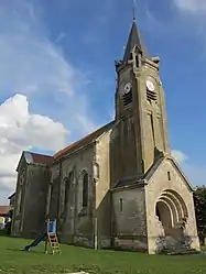 The church in Saint-Baussant | |
 Coat of arms | |
Location of Saint-Baussant | |
 Saint-Baussant  Saint-Baussant | |
| Coordinates: 48°53′36″N 5°47′34″E / 48.8933°N 5.7928°E | |
| Country | France |
| Region | Grand Est |
| Department | Meurthe-et-Moselle |
| Arrondissement | Toul |
| Canton | Le Nord-Toulois |
| Intercommunality | Mad et Moselle |
| Government | |
| • Mayor (2020–2026) | Didier Merchat[1] |
| Area 1 | 8.92 km2 (3.44 sq mi) |
| Population | 70 |
| • Density | 7.8/km2 (20/sq mi) |
| Time zone | UTC+01:00 (CET) |
| • Summer (DST) | UTC+02:00 (CEST) |
| INSEE/Postal code | 54470 /54470 |
| Elevation | 217–297 m (712–974 ft) (avg. 230 m or 750 ft) |
| 1 French Land Register data, which excludes lakes, ponds, glaciers > 1 km2 (0.386 sq mi or 247 acres) and river estuaries. | |
Saint-Baussant (French pronunciation: [sɛ̃ bosɑ̃]) is a commune in the Meurthe-et-Moselle department in north-eastern France.[3]
It was formerly known as Saint-Baussonne, ultimately from Sanctus Balsamus.
The Rupt de Mad flows northeastward through the middle of the commune and forms part of its northern border.
See also
References
- ↑ "Répertoire national des élus: les maires". data.gouv.fr, Plateforme ouverte des données publiques françaises (in French). 9 August 2021.
- ↑ "Populations légales 2021". The National Institute of Statistics and Economic Studies. 28 December 2023.
- ↑ INSEE commune file
Wikimedia Commons has media related to Saint-Baussant.
This article is issued from Wikipedia. The text is licensed under Creative Commons - Attribution - Sharealike. Additional terms may apply for the media files.