Mittelhausbergen
| |
|---|---|
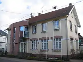 The town hall in Mittelhausbergen | |
.svg.png.webp) Coat of arms | |
Location of Mittelhausbergen | |
 Mittelhausbergen  Mittelhausbergen | |
| Coordinates: 48°36′53″N 7°41′37″E / 48.6147°N 7.6936°E | |
| Country | France |
| Region | Grand Est |
| Department | Bas-Rhin |
| Arrondissement | Strasbourg |
| Canton | Hœnheim |
| Intercommunality | Strasbourg Eurométropole |
| Government | |
| • Mayor (2020–2026) | Bernard Egles[1] |
| Area 1 | 1.72 km2 (0.66 sq mi) |
| Population | 2,094 |
| • Density | 1,200/km2 (3,200/sq mi) |
| Time zone | UTC+01:00 (CET) |
| • Summer (DST) | UTC+02:00 (CEST) |
| INSEE/Postal code | 67296 /67206 |
| Elevation | 144–192 m (472–630 ft) |
| 1 French Land Register data, which excludes lakes, ponds, glaciers > 1 km2 (0.386 sq mi or 247 acres) and river estuaries. | |
Mittelhausbergen (French: [mitœlawsbɛʁɡœn], German: [ˈmɪtl̩haʊsˌbɛʁɡn̩]; Alsatian: Míttelhüsbàrje [mɪd̥əlhysˈb̥aʁjə]) is a commune in the Bas-Rhin department in Grand Est in north-eastern France.[3]
Population
| Year | Pop. | ±% p.a. |
|---|---|---|
| 1968 | 504 | — |
| 1975 | 852 | +7.79% |
| 1982 | 1,169 | +4.62% |
| 1990 | 1,425 | +2.51% |
| 1999 | 1,680 | +1.85% |
| 2007 | 1,750 | +0.51% |
| 2012 | 1,768 | +0.20% |
| 2017 | 1,984 | +2.33% |
| Source: INSEE[4] | ||
See also
References
- ↑ "Répertoire national des élus: les maires". data.gouv.fr, Plateforme ouverte des données publiques françaises (in French). 2 December 2020.
- ↑ "Populations légales 2021". The National Institute of Statistics and Economic Studies. 28 December 2023.
- ↑ INSEE commune file
- ↑ Population en historique depuis 1968, INSEE
Wikimedia Commons has media related to Mittelhausbergen.
This article is issued from Wikipedia. The text is licensed under Creative Commons - Attribution - Sharealike. Additional terms may apply for the media files.