Witternheim | |
|---|---|
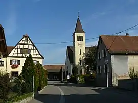 The church in Witternheim | |
.svg.png.webp) Coat of arms | |
Location of Witternheim | |
 Witternheim  Witternheim | |
| Coordinates: 48°18′53″N 7°36′46″E / 48.3147°N 7.6128°E | |
| Country | France |
| Region | Grand Est |
| Department | Bas-Rhin |
| Arrondissement | Sélestat-Erstein |
| Canton | Erstein |
| Intercommunality | Canton d'Erstein |
| Government | |
| • Mayor (2020–2026) | Philippe Braun[1] |
| Area 1 | 4.99 km2 (1.93 sq mi) |
| Population | 498 |
| • Density | 100/km2 (260/sq mi) |
| Time zone | UTC+01:00 (CET) |
| • Summer (DST) | UTC+02:00 (CEST) |
| INSEE/Postal code | 67545 /67230 |
| Elevation | 159–163 m (522–535 ft) (avg. 160 m or 520 ft) |
| 1 French Land Register data, which excludes lakes, ponds, glaciers > 1 km2 (0.386 sq mi or 247 acres) and river estuaries. | |
Witternheim (French pronunciation: [vitəʁnaim]) is a commune in the Bas-Rhin department in Grand Est in north-eastern France.[3]
Population
| Year | Pop. | ±% p.a. |
|---|---|---|
| 1968 | 316 | — |
| 1975 | 274 | −2.02% |
| 1982 | 353 | +3.69% |
| 1990 | 386 | +1.12% |
| 1999 | 382 | −0.12% |
| 2007 | 524 | +4.03% |
| 2012 | 517 | −0.27% |
| 2017 | 507 | −0.39% |
| Source: INSEE[4] | ||
See also
References
- ↑ "Répertoire national des élus: les maires". data.gouv.fr, Plateforme ouverte des données publiques françaises (in French). 2 December 2020.
- ↑ "Populations légales 2021". The National Institute of Statistics and Economic Studies. 28 December 2023.
- ↑ INSEE commune file
- ↑ Population en historique depuis 1968, INSEE
Wikimedia Commons has media related to Witternheim.
This article is issued from Wikipedia. The text is licensed under Creative Commons - Attribution - Sharealike. Additional terms may apply for the media files.