Monthodon | |
|---|---|
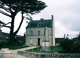 The town hall in Monthodon | |
Location of Monthodon | |
 Monthodon  Monthodon | |
| Coordinates: 47°39′02″N 0°50′14″E / 47.6506°N 0.8372°E | |
| Country | France |
| Region | Centre-Val de Loire |
| Department | Indre-et-Loire |
| Arrondissement | Loches |
| Canton | Château-Renault |
| Government | |
| • Mayor (2022–2026) | Frédéric Laugis[1] |
| Area 1 | 33.91 km2 (13.09 sq mi) |
| Population | 642 |
| • Density | 19/km2 (49/sq mi) |
| Time zone | UTC+01:00 (CET) |
| • Summer (DST) | UTC+02:00 (CEST) |
| INSEE/Postal code | 37155 /37110 |
| Elevation | 115–172 m (377–564 ft) |
| 1 French Land Register data, which excludes lakes, ponds, glaciers > 1 km2 (0.386 sq mi or 247 acres) and river estuaries. | |
Monthodon (French pronunciation: [mɔ̃tɔdɔ̃] ⓘ) is a commune in the Indre-et-Loire department in central France.
Population
| Year | Pop. | ±% p.a. |
|---|---|---|
| 1968 | 673 | — |
| 1975 | 579 | −2.13% |
| 1982 | 560 | −0.48% |
| 1990 | 547 | −0.29% |
| 1999 | 559 | +0.24% |
| 2007 | 630 | +1.51% |
| 2012 | 608 | −0.71% |
| 2017 | 631 | +0.75% |
| Source: INSEE[3] | ||
Sights
See also
References
- ↑ "Répertoire national des élus: les maires" (in French). data.gouv.fr, Plateforme ouverte des données publiques françaises. 6 June 2023.
- ↑ "Populations légales 2021". The National Institute of Statistics and Economic Studies. 28 December 2023.
- ↑ Population en historique depuis 1968, INSEE
Wikimedia Commons has media related to Monthodon.
This article is issued from Wikipedia. The text is licensed under Creative Commons - Attribution - Sharealike. Additional terms may apply for the media files.