Villedômer | |
|---|---|
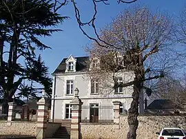 Town hall | |
Location of Villedômer | |
 Villedômer  Villedômer | |
| Coordinates: 47°32′48″N 0°53′21″E / 47.5467°N 0.8892°E | |
| Country | France |
| Region | Centre-Val de Loire |
| Department | Indre-et-Loire |
| Arrondissement | Loches |
| Canton | Château-Renault |
| Government | |
| • Mayor (2020–2026) | Chantal Gonzalez-Bourges[1] |
| Area 1 | 35.49 km2 (13.70 sq mi) |
| Population | 1,310 |
| • Density | 37/km2 (96/sq mi) |
| Time zone | UTC+01:00 (CET) |
| • Summer (DST) | UTC+02:00 (CEST) |
| INSEE/Postal code | 37276 /37110 |
| Elevation | 72–154 m (236–505 ft) |
| 1 French Land Register data, which excludes lakes, ponds, glaciers > 1 km2 (0.386 sq mi or 247 acres) and river estuaries. | |
Villedômer (French pronunciation: [vildome] ⓘ) is a commune in the Indre-et-Loire department in central France.
Population
| Year | Pop. | ±% p.a. |
|---|---|---|
| 1968 | 769 | — |
| 1975 | 992 | +3.70% |
| 1982 | 1,116 | +1.70% |
| 1990 | 1,095 | −0.24% |
| 1999 | 1,135 | +0.40% |
| 2007 | 1,278 | +1.49% |
| 2012 | 1,378 | +1.52% |
| 2017 | 1,359 | −0.28% |
| Source: INSEE[3] | ||
See also
References
- ↑ "Répertoire national des élus: les maires" (in French). data.gouv.fr, Plateforme ouverte des données publiques françaises. 13 September 2022.
- ↑ "Populations légales 2021". The National Institute of Statistics and Economic Studies. 28 December 2023.
- ↑ Population en historique depuis 1968, INSEE
Wikimedia Commons has media related to Villedômer.
This article is issued from Wikipedia. The text is licensed under Creative Commons - Attribution - Sharealike. Additional terms may apply for the media files.