Morcolla | |
|---|---|
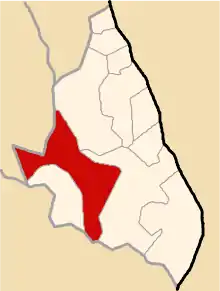 Location of Morcolla in the Sucre province | |
| Country | |
| Region | Ayacucho |
| Province | Sucre |
| Founded | December 21, 1956 |
| Capital | Morcolla |
| Subdivisions | 31 populated places |
| Area | |
| • Total | 289.34 km2 (111.71 sq mi) |
| Elevation | 3,459 m (11,348 ft) |
| Population | |
| • Total | 2,190 |
| • Density | 7.6/km2 (20/sq mi) |
| Time zone | UTC-5 (PET) |
| UBIGEO | 050906 |
Morcolla is one of 11 districts of the Sucre Province in the Ayacucho region in Peru.
Population
The population of Morcolla is 2,190 people, 1,088 men and 1,102 women.[1]
Geography
One of the highest peaks of the district is Rasuwillka at approximately 5,000 m (16,000 ft). Other mountains are listed below:[2]
- Apu Pumani
- Chillwa Chillwa
- Iskulla
- Kunturisa
- K'ark'ani
- Murqulla Urqu
- Pallqa Urqu
- Pallqacha
- Pata Wasi
- Puka Qaqa
- Pukarilla
- Qalalu
- Qucha Urqu
- Q'ala Pukyu
- Q'illu Q'illu
- Sinaqa Sinqa
- T'akra Silla
- Waychawlla
- Yana Yana
- Yawyu
Ethnic groups
The people in the district are mainly indigenous citizens of Quechua descent. Quechua is the language which the majority of the population (85.58%) learnt to speak in childhood, 14.22% of the residents started speaking using the Spanish language (2007 Peru Census).[3]
Administrative division
The populated places in the district are:[1]
|
|
|
References
- 1 2 INEI Archived 2007-06-01 at the Wayback Machine
- ↑ escale.minedu.gob.pe/ UGEL map Sucre Province (Ayacucho Region)
- ↑ inei.gob.pe Archived 2013-01-27 at the Wayback Machine INEI, Peru, Censos Nacionales 2007, Frequencias: Preguntas de Población: Idioma o lengua con el que aprendió hablar (in Spanish)
| |
|---|---|
| Cangallo | |
| Huamanga | |
| Huanca Sancos | |
| Huanta | |
| La Mar | |
| Lucanas | |
| Parinacochas | |
| Paucar del Sara Sara | |
| Sucre | |
| Víctor Fajardo | |
| Vilcas Huamán | |
This article is issued from Wikipedia. The text is licensed under Creative Commons - Attribution - Sharealike. Additional terms may apply for the media files.