Ningming County
宁明县 · Ningzmingz Yen | |
|---|---|
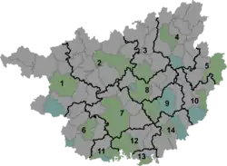 Ningming Location of the seat in Guangxi | |
| Coordinates: 22°08′24″N 107°04′34″E / 22.140°N 107.076°E | |
| Country | People's Republic of China |
| Region | Guangxi |
| Prefecture-level city | Chongzuo |
| Township-level divisions | 4 towns 9 townships |
| County seat | Chengzhong (城中镇) |
| Area | |
| • Total | 3,779 km2 (1,459 sq mi) |
| Elevation | 118 m (387 ft) |
| Population (2010) | |
| • Total | 412,300 |
| • Density | 110/km2 (280/sq mi) |
| Time zone | UTC+8 (China Standard) |
| Website | nm |
Ningming County (simplified Chinese: 宁明县; traditional Chinese: 寧明縣; pinyin: Níngmíng Xiàn, Zhuang: Ningzmingz Yen) is a county in southwestern Guangxi, China. It is famous for being home to the Hua mountain rock paintings World Heritage Site. A diverse range of languages and dialects are spoken alongside Mandarin Chinese, including local Yue Chinese called Pak Va (白话), Zuojiang Zhuang (左江壮语). It is under the administration of the prefecture-level city of Chongzuo and borders Vietnam's provinces of Lạng Sơn and Quảng Ninh.
Administrative divisions
There are 4 towns and 9 townships in the county:[1]
Towns:
- Chengzhong (城中镇) Literally 'city county' known as Ningming (宁明) by locals, Aidian (爱店镇), Mingjiang (明江镇), Haiyuan (海渊镇)
Townships:
- Tingliang Township (亭亮乡), Zhai'an Township (寨安乡), Zhilang Township (峙浪乡), Dong'an Township (东安乡), Bangun Township (板棍乡), Beijiang Township (北江乡), Tongmian Township (桐棉乡), Nakan Township (那堪乡), Nanan Township (那楠乡)
Climate
| Climate data for Ningming (1991−2020 normals) | |||||||||||||
|---|---|---|---|---|---|---|---|---|---|---|---|---|---|
| Month | Jan | Feb | Mar | Apr | May | Jun | Jul | Aug | Sep | Oct | Nov | Dec | Year |
| Mean daily maximum °C (°F) | 18.1 (64.6) |
20.5 (68.9) |
23.1 (73.6) |
28.2 (82.8) |
31.6 (88.9) |
32.9 (91.2) |
33.0 (91.4) |
32.6 (90.7) |
31.5 (88.7) |
28.7 (83.7) |
24.9 (76.8) |
20.4 (68.7) |
27.1 (80.8) |
| Daily mean °C (°F) | 13.9 (57.0) |
16.0 (60.8) |
18.9 (66.0) |
23.5 (74.3) |
26.7 (80.1) |
28.1 (82.6) |
28.2 (82.8) |
27.5 (81.5) |
26.4 (79.5) |
23.6 (74.5) |
19.6 (67.3) |
15.3 (59.5) |
22.3 (72.2) |
| Mean daily minimum °C (°F) | 10.9 (51.6) |
12.8 (55.0) |
16.0 (60.8) |
20.1 (68.2) |
23.1 (73.6) |
24.7 (76.5) |
24.9 (76.8) |
24.3 (75.7) |
22.9 (73.2) |
19.8 (67.6) |
15.7 (60.3) |
11.7 (53.1) |
18.9 (66.0) |
| Average precipitation mm (inches) | 34.6 (1.36) |
24.9 (0.98) |
49.0 (1.93) |
68.1 (2.68) |
144.6 (5.69) |
170.4 (6.71) |
189.4 (7.46) |
215.3 (8.48) |
115.0 (4.53) |
60.9 (2.40) |
38.2 (1.50) |
27.3 (1.07) |
1,137.7 (44.79) |
| Average precipitation days (≥ 0.1 mm) | 9.4 | 8.5 | 11.2 | 10.1 | 13.6 | 16.4 | 16.2 | 17.6 | 11.3 | 7.8 | 6.4 | 6.5 | 135 |
| Average relative humidity (%) | 78 | 78 | 80 | 78 | 77 | 81 | 81 | 84 | 81 | 77 | 77 | 75 | 79 |
| Mean monthly sunshine hours | 74.8 | 75.0 | 65.6 | 116.2 | 177.1 | 176.3 | 195.1 | 192.2 | 182.7 | 171.9 | 142.3 | 119.3 | 1,688.5 |
| Percent possible sunshine | 22 | 23 | 18 | 30 | 43 | 44 | 48 | 49 | 50 | 48 | 43 | 36 | 38 |
| Source: China Meteorological Administration[2][3] | |||||||||||||
References
- ↑ 2011年统计用区划代码和城乡划分代码:宁明县 (in Chinese). National Bureau of Statistics of the People's Republic of China. Archived from the original on 2012-07-21. Retrieved 2013-01-02.
- ↑ 中国气象数据网 – WeatherBk Data (in Simplified Chinese). China Meteorological Administration. Retrieved 27 August 2023.
- ↑ 中国气象数据网 (in Simplified Chinese). China Meteorological Administration. Retrieved 27 August 2023.
External links
This article is issued from Wikipedia. The text is licensed under Creative Commons - Attribution - Sharealike. Additional terms may apply for the media files.