Nivillac
Nivilieg | |
|---|---|
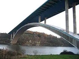 The Morbihan Bridge | |
.svg.png.webp) Coat of arms | |
Location of Nivillac | |
 Nivillac  Nivillac | |
| Coordinates: 47°32′05″N 2°16′52″W / 47.5347°N 2.2811°W | |
| Country | France |
| Region | Brittany |
| Department | Morbihan |
| Arrondissement | Vannes |
| Canton | Muzillac |
| Intercommunality | CC Arc Sud Bretagne |
| Government | |
| • Mayor (2022–2026) | Guy David[1] |
| Area 1 | 55.48 km2 (21.42 sq mi) |
| Population | 4,810 |
| • Density | 87/km2 (220/sq mi) |
| Time zone | UTC+01:00 (CET) |
| • Summer (DST) | UTC+02:00 (CEST) |
| INSEE/Postal code | 56147 /56130 |
| Elevation | 0–71 m (0–233 ft) |
| 1 French Land Register data, which excludes lakes, ponds, glaciers > 1 km2 (0.386 sq mi or 247 acres) and river estuaries. | |
Nivillac (French pronunciation: [nivijak]; Breton: Nivilieg) is a commune in the Morbihan department and Brittany region of north-western France.[3]
Population
| Year | Pop. | ±% p.a. |
|---|---|---|
| 1968 | 2,727 | — |
| 1975 | 2,661 | −0.35% |
| 1982 | 3,103 | +2.22% |
| 1990 | 3,101 | −0.01% |
| 1999 | 3,192 | +0.32% |
| 2007 | 3,766 | +2.09% |
| 2012 | 4,273 | +2.56% |
| 2017 | 4,612 | +1.54% |
| Source: INSEE[4] | ||
In French the inhabitants of Nivillac are known as Nivillacois.
See also
References
- ↑ "Répertoire national des élus: les maires" (in French). data.gouv.fr, Plateforme ouverte des données publiques françaises. 4 May 2022.
- ↑ "Populations légales 2021". The National Institute of Statistics and Economic Studies. 28 December 2023.
- ↑ INSEE commune file
- ↑ Population en historique depuis 1968, INSEE
External links
Wikimedia Commons has media related to Nivillac.
- Base Mérimée: Search for heritage in the commune, Ministère français de la Culture. (in French)
- Mayors of Morbihan Association (in French)
This article is issued from Wikipedia. The text is licensed under Creative Commons - Attribution - Sharealike. Additional terms may apply for the media files.